
Set up your Free Trade Account now
Call us on 01856 898 066 or click the link below to fill in our online form.
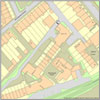
CAD Mapping
Our CAD maps are keenly priced and come with free height data. For more information please see our Ordnance Survey CAD mapping page.
OS Height Data
Ordnance Survey contours at 5m intervals are available with every DWG and DXF format map. More detailed height data is available with the Digital Terrain Model, for £12.75 with any DWG or DXF map.
For more information please see our CAD Mapping page.
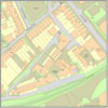
Shapefiles now Free
We now offer free shapefiles with all purchases at UK Planning Maps. For more information please see our shapefile information page.
Very good website, easy to navigate and use. Extremely fast results and well priced.
Really easy to use, thank you very much planning maps.
Much easier to use than I had expected. Good clear maps.
Very helpful and prompt service
Excellent service - Rachel was incredibly helpful and knowledgeable and the map was online almost before I had out the phone down. Would definitely use them again.
Quick, easy and good graphical quality.
Quick and easy to use
Perfect as always
Quick responce, reseasonable price and high quality of products.
Great service, nothing to much trouble, helpful and knowledgeable
Excellent. I like the facility that allows me to go back and edit maps if I need to.
Very good service and the price is very competitive.
I always find this site easy to use. great place at a good price
Fast and efficient service and good value foe money
Very easy to locate and download the information in DWG format
Cheap instant OS tiles
No probs easy to use
Very easy and quick to use. Just downloaded a .dwg plan to add cable routing for an outdoor site.
Very easy to use and reliable service!
Nice and clear - easy to use - just the job
Quick and easy to recive, the information which i need.
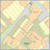
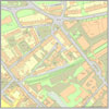
Our pdf maps are our most popular format for submitting planning application. If you want to edit the map document you can select MS Word format. All maps are available in both colour and black and white.
| A4 Paper Size | Samples | Price | |
|---|---|---|---|
 |
Block Plan 18m x 18m 1:100 Scale |
£7.23 | |
|
Block Plan 36m x 36m 1:200 Scale |
£8.08 | |
 |
Block Plan 90m x 90m 1:500 Scale |
£11.05 | |
 |
Location Plan 2 Hectares 1:1,250 Scale |
£14.88 | |
 |
Location Plan 4 Hectares 1:1,250 Scale |
£22.53 | |
 |
Location Plan 8 Hectares 1:2,500 Scale |
£50.15 | |
|
Location Plan 16 Hectares 1:2,500 Scale |
£59.50 |
| A3 Paper Size | Samples | Price | |
|---|---|---|---|
|
Block Plan 28 x 28 m 1:100 Scale |
£15.30 | |
|
Block Plan 52m x 52m 1:200 Scale |
£17 | |
|
Block Plan 128m x 128m 1:500 Scale |
£21.25 | |
|
Location Plan 9 Hectares 1:1,250 Scale |
£37.83 | |
|
Location Plan 36 Hectares 1:2,500 Scale |
£95.63 |
| A2 Paper Size | Samples | Price | |
|---|---|---|---|
|
Block Plan 3.61 Hectares 1:500 Scale |
£25.49 | |
|
Location Plan 22.56 Hectares 1:1,250 Scale |
£83.30 | |
|
Location Plan 90.25 Hectares 1:2,500 Scale |
£112.20 |
| A1 Paper Size | Samples | Price | |
|---|---|---|---|
|
Block Plan 7.62 Hectares 1:500 Scale |
£33.58 | |
|
Location Plan 47.61 Hectares 1:1,250 Scale |
£93.50 | |
|
Location Plan 190.44 Hectares 1:2,500 Scale |
£153 |
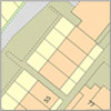
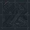
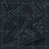
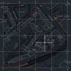
Contour lines at 5m height intervals can be added to all DXF/DWG maps. If you require more detailed height information we have a Digital Terrain Model (DTM) option that gives mean average heights for every 5m square across Great Britain.
| samples | price | ||
|---|---|---|---|
 |
DWG/DXF CAD Map 1 Hectare 100m x 100m |
£13.60 | |
 |
DWG/DXF CAD Map 2 Hectares 141.42m x 141.42m |
£21.25 | |
 |
DWG/DXF CAD Map 4 Hectares 200m x 200m |
£43.35 | |
 |
DWG/DXF CAD Map 10 Hectares 316m x 316m |
£102.85 | |
|
DWG/DXF CAD Map 20 Hectares 447m x 447m |
£169.15 | |
|
DWG/DXF CAD Map 50 Hectares 707m x 707m |
£250.75 | |
|
DWG/DXF CAD Map 100 Hectares 1000m x 1000m |
£348.50 | |
|
Digital Terrain Model | £12.75/ha |
All prices are subject to VAT at the prevailing rate.
Height Data
All DXF/DWG files can include 5m contour lines.
DTM data giving mean heights for every 5m square are also available for a small fee.
15% off All Orders.
With a Trade Account you automatically receive a 15% discount on all orders. The prices above reflect the discount.
No codes needed.