
Find your Plan Now:
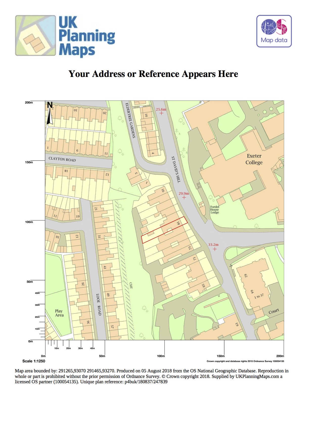
advanced searchExample of acceptable Site Location Plan:
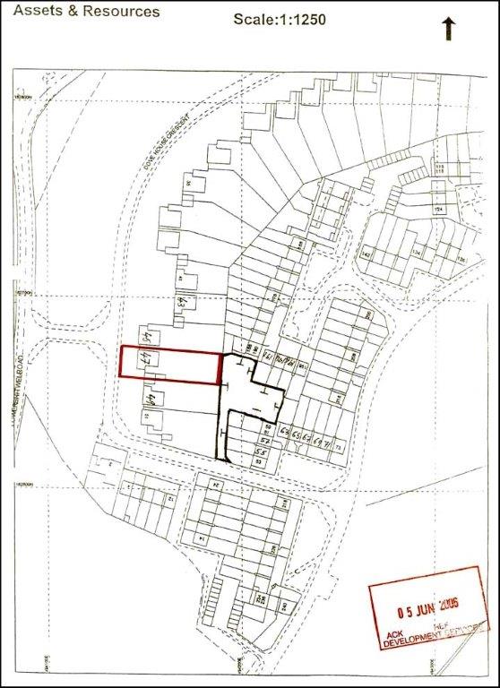
Example of a rejected Site Location Plan:
Order by Phone on: 01856 898 022
Check your Site Location Plan
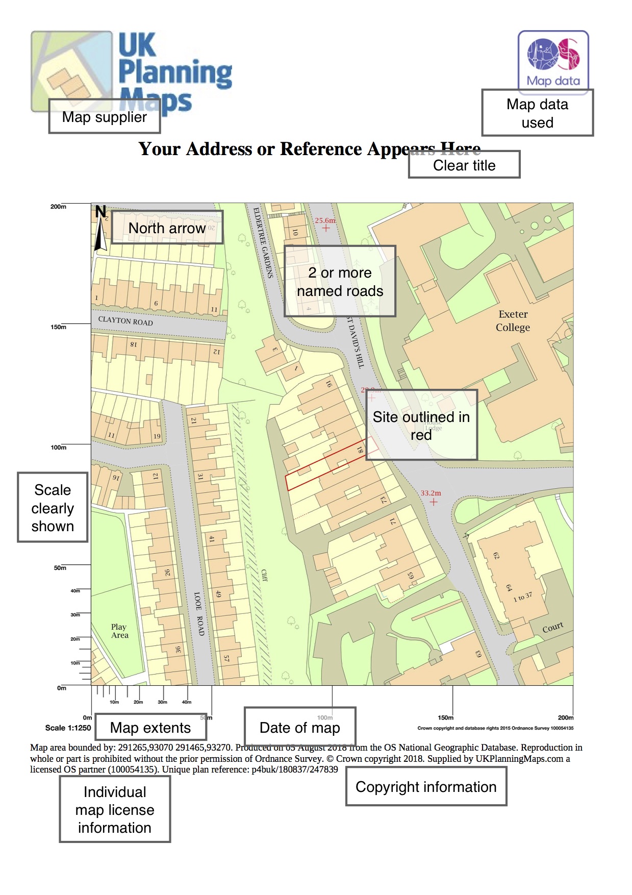
To ensure you get your Site Location Plan right first time please see our Diagram of a Site Location Plan
DiagramofApprovedSiteLocationPlan.pdf
This was easy to use and very helpful
Very quick and easy.
Helpful, offering a competitive price.
Excellent. Located the map I needed quickly, set scale, marked out boundaries and ordered it. Only negative was the time I actually took to find the site in the first place, maybe consider endorsement from local and gov agencies such as Crofters Commission etc. Recommended.
What is it with Planners and the ‘we must have a 1:1250 OS map” when there are so many other options these days... Anyway, found this lot quite accidentally, but good that i did. Easy to download, included all the files I needed (including CAD), and very inexpensive. Have bookmarked and will use again.
Quick and easy to use - ideal for use with planning applications I found the red and blue pencil markers easy to use except where the lines came close together - then it took several attempts
A great service from this company, instant accesss to the maps i required for my planning application
I was able to achieve all I wanted to via this site. The cost is competitive, and being able to use the drawing tool to annotate the map to suite the planning requirements was a must. It was subsequently accepted by planning and I wouldn't hesitate to use again.
Probably the best of the bunch, just what you need when your heeds bursting wae planning pish.
Service very good, but could offer more free enquiries for investigation purposes. Support by telephone was both very good and prompt. Rate the support at Five Star.
Really easy to use and mark up the property boundary. Will use again!
First time to need this service and found the staff very helpful with assisting the purchase of two plans, a Location and a Block plan. Thank you
Easy to get the map using the postcode.
Great service the extra hard copy maps are great and arrived promptly, good quality
IT was very easy to use, and produced a valid location map within minutes
System didn't let me locate a very rural area with no postcode - it kept timing me out, and saying that I had used my quota of searches. But that is a problem on competitor websites as well. I phoned UK Planning Maps - Colin helped me immediately and set up the plans required. Great to be able to speak to people who can help.
UK Planning Maps were great to deal with,was able to speak to a very helpful man who understood exactly what was needed.Absolutely excellent.
Exactly as required for a planning application.
An excellent service with outstanding results which I would highly recommend. I needed extra search availability and your team were extremely prompt, efficient and courteous and enabled me to complete my searches by adding extra availability almost immediately, extremely professional from start to finish. I will definitely use your services again if needed and already recommeded you to another family member who also requires a detailed location map.
Once I had cracked procedures over internet I was very happy. Direct phone contact was most helpful to somebody not too well up on modern technology !
Quick and efficient service I downloaded my map within a few minutes of buying it.
Site Location Plan At a Glance
Normal Scales: 1:1,250 and 1:2,500
Paper Size: A4 or A3
Coverage: Urban 4 hectares, Rural 16 hectares
File Type: PDF or Printed copies
Must include: North Arrow, Scale, Licence Number
Colour Format: Black and White or Colour
What is a Site Location Plan?
All planning applications* need a site location plan (also known as a location plan) which shows the proposal in its surrounding context and a block plan (also known as a site plan) which shows the development in more detail.
These plans enable the local planning authority (LPA) to identify the land to which the application refers to and should be based on an up-to-date Ordnance Survey map. This guide outlines what plans you must submit with your application. You can create and buy both sets of plans from Stanfords and attach them to your online application. If you are posting your application, three copies plus the original are required.
Site location plan:
- Should be at an identified standard metric scale (typically 1:1250 or 1:2500 for larger sites) and should show the direction North.
- It should be scaled to fit on either A4 or A3 paper
- Show sufficient roads and/or buildings on land adjoining the application site
- Show application site boundary and all land necessary to carry out the proposed
- development i.e. land required for access to the site from the road, outlined in red
- A blue line should be drawn around any other land owned by the applicant, close to or
- adjoining the application site.
*This guidance is based on the criteria set out in the Government guidance document Guidance on information requirements and validation. Please note that other plans may be requested by your LPA as part of its local level requirements.
What Maps are used for Site Location Plans?
Your council will require up to date high quality mapping. Along with most other providers we offer Location Plans based on Ordnance Survey Matermap® data. As the National Mapping Agency of Great Britain their coverage is unrivalled and it's guaranteed to be accepted by your planning department.
All of our Site Location plans are guaranteed to meet your council's requirements for planning applications.
What does the Site Location Plan need to show?
It should show the application site boundary and all land necessary to carry out the proposed development i.e. land required for access to the site from the road. In practice this often means your house and it's garden front and back to the road. Many Councils ask for your Location Plan to show 2 named roads to enable them to locate the development.
You need to mark out the boundary of your application site in red. If you own other land nearby this should be outlined in blue.
What File Type are you required to submit?
You will need to upload at PDF if you are submitting your application online via the planning portal. If you are submitting paper copies of your application you can order the PDF with paper copies.
It's important not to print your PDF at home, as every paper copy of the map should be licensed. Please order the paper copies with your map to ensure you are using licensed copies.
How Much will the Site Location Plan cost?
You can create your Site Location Plan yourself online which can cost as little as £13.00 + VAT for the pdf. Some companies do charge more than this so it does pay to shop around.
Bear in mind that if you buy from one of the Suppliers that pay to advertise on the Planning Portal your map will cost more, however it is exactly the same map as provided by all the Ordnance Survey licensed partners.
If you have your architect create your plan you will also need to pay their fees as well.
Diagram of Site Location Plan
Please review our diagram of a Site Location Plan. This shows the necessary elements of your Site Location Plan.
Where can you get more help?
Our Guide to the Planning Process