Find your Plan Now:
advanced searchOrder by Phone on: 01856 898 022
Our Site Location Plans Are...
- Cheapest Online
- Guaranteed for planning
- Most up to date available
- Emailed to you immediately
- Come with free print copies
Check your Site Location Plan
To ensure you get your Site Location Plan right first time please see our Diagram of a Site Location Plan
What is a Site Location Plan and why do I need one?
Most planning applications need a site location plan which shows the proposed development in its surrounding context and a block plan or site plan which shows the development in more detail. These plans enable the local planning authority (LPA) to identify the land to which the application refers to and should be based on an up-to-date Ordnance Survey map.
For more information on the kind of applications that require these plans please see What is a Block Plan and why do I need one.
This guide specifies the location plan you must submit with your planning application. You can create and buy the plan you need from us and attach this to your online application. If you are posting your application, three copies of your location Plan plus the original are required; we can supply 6 hard copies with each order.
Site Location Plan Requirements
Your site location plan must conform with a fairly rigid set of requirements. If it doesn’t, then your planning application is likely to be rejected, delaying the process and possibly costing you money.
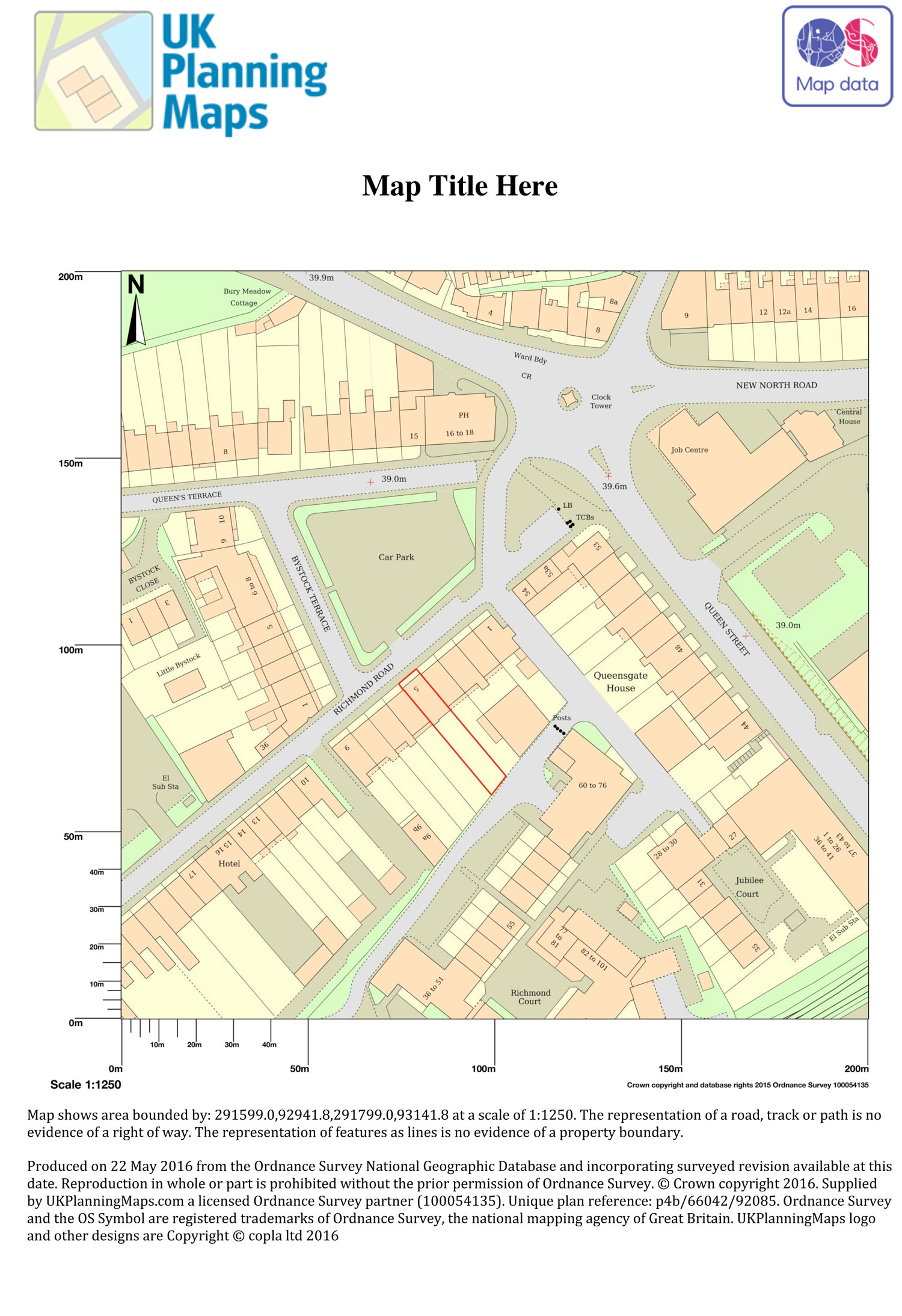
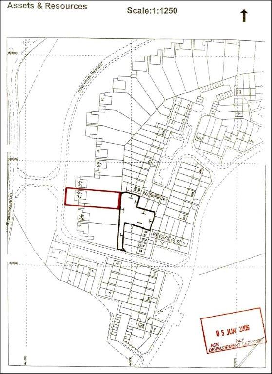
The location plan should indicate the direction of north. It must be drawn to a standard specified metric scale; typically, scales are at 1:1250 or 1:2500 for larger sites. It should also be sized to fit on either A3 or A4 paper.
Other requirements include:
- Buildings and roads on adjoining land should be shown
- The site boundary and any land that is needed to undertake the development such as for access must be shown and outlined in red
- Any additional land owned by the applicant and close to or adjoining the site must be outlined in blue
Obtaining your Location Plan
You can create and buy your location and block plan directly from this website and attach it to your online application. If you are posting your application, three copies of your Location Plan plus the original are required. We supply six copies in either black and white or colour with each order.
Other features include:
- You are able to view your plan before you purchase it
- You can annotate the plan and highlight boundaries
- Plans are provided in the right format for attaching to your application
- You can purchase your plan immediately when you need it
Please read through the information on this page to ensure you select the Block Plan you need. If you need any help creating your Location Plan, please give us a call on our helpline 01856 898 022.
Why you should buy a Location Plan from us
We use Ordnance Survey Matermap® data which is the best data available for your Location Plan and is guaranteed to be acceptable by planning authorities. When you buy a Location Plan from us we guarantee that it will be accepted by all Local Planning Authorities for planning applications. We are also competitively priced.
Additionally:
- The plan is created using current Ordnance Survey mapping
- It is correctly scaled
- The correct license is in place
- The plan is completely up to date
- It has not been used for a previous application
- It is correctly marked up
Submitting an invalid plan will delay your application and could cost you money. Our plans are guaranteed to be acceptable first time round. They are competitively priced too.
There are a number of other applications you may need a site location plan for, please see our site location plan page for more information and call us if you need further details.
What Maps are used for Site Plans?
We use Ordnance Survey Matermap® data. We can confidently say this is the best data available for your site plan. Heres what Ordnance Survey say about their Mastermaps®
"It is a continually updated database, containing 450 million geographic features found in the real world..." read more
All of our Site Location plans are guaranteed to meet your council's requirements for planning applications.
Example of Site Location Plan rejected by Council
Example of Acceptable Site Location Plan