
8 Planning Map Mistakes That Delay Applications
You’ve checked the drawings, filled in the forms and finally reached the upload screen. Then the council asks for a replacement map. It’s frustrating, particularly when the problem is something small: a missing access route, an unclear boundary or a PDF that has been resized. These are the planning map mistakes worth catching before you press submit.
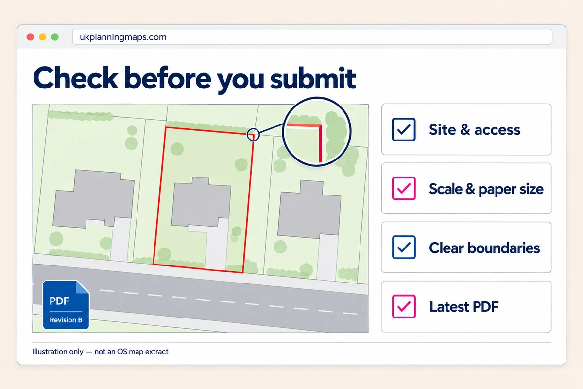
You don’t need to become a cartographer to get this right. You need the appropriate plans, a clear application boundary and a few minutes with the finished files. Here are eight checks that can save another round of emails.
Why planning maps cause avoidable delays
The validation team needs to identify the site and check that the application includes the required information. A map problem can hold up that process; it is not the same as refusing planning permission because the proposal is unacceptable.
Our location plan and site plan guide explains their different jobs. Check which drawings your architect is already supplying before buying another copy.
The national guidance referred to below applies to England. Requirements elsewhere in the UK, and for different application types, need checking separately.
1. Choosing the wrong planning map scale
A closer view is not automatically a better plan. Your location plan needs enough surrounding area to identify the property; your site plan needs enough detail to explain the layout.
Location plans commonly use 1:1250 or 1:2500. Site and block plans often use 1:500 or 1:200. Our planning map scales guide explains the choices.
For a rural house, check that the access track fits as well as the building. If the coverage is too tight, choose a suitable wider view or paper size rather than squeezing the image into a smaller space.
When printing, use the stated paper size and “Actual size” or 100%. “Fit to page” can change the printed scale. Check the print preview for clipping too; Adobe explains how these settings affect the output.
2. Outlining the wrong land
Start with the land needed for the proposal, not just the outline of the house. An extension may also involve access, parking or landscaping outside the new building’s footprint.
In England, the red line should enclose all land necessary for the development. Other land owned by the applicant, close to or adjoining the application site, should be outlined in blue. Simply using or controlling land does not make it blue-line land.
Land owned by someone else may still need to be inside the red line. Don’t omit a necessary access strip just because it has a different owner. The appropriate ownership certificate and notices must be addressed; ask your agent if you are unsure. These distinctions are covered in government guidance on plans and ownership.
A line on a map does not settle ownership or access rights.
3. Making boundary lines too faint or unclear
A boundary can look fine while you are drawing it, then almost disappear when the whole page is displayed. The opposite happens too: a thick red line hides the very wall or entrance it is meant to follow.
Keep the outline connected and readable. Inspect awkward corners closely, then zoom back out. Can someone unfamiliar with the property follow the boundary without guessing?
Check the downloaded PDF, not just the drawing screen. Make sure the boundary has actually been included and is not clipped at the edge.
If you get stuck, ask. In a customer review shown on our homepage, S P George described how Evelyn helped draw boundary lines and add a road name for a rural site. That is useful help with presenting a site, not a substitute for confirming which land belongs in the application.
4. Sending an unlicensed or unsuitable base map
An old estate agent’s brochure or a map saved on your laptop might look convenient. That does not establish whether it is suitable, current enough or licensed for the application.
An HM Land Registry title plan is another easy trap. Ordnance Survey’s guidance says these title plans must not be used for planning applications. Obtain appropriate planning mapping instead of recycling the title-plan copy.
Google Maps screenshots also should not replace the required application drawings; our Google Maps guide explains the scale and usage issues.
UK Planning Maps supplies licensed OS base mapping. Keep its copyright and licence information visible, and check the mapped features against the site. Even good mapping may not show a recent demolition or new outbuilding.
5. Forgetting the north point, scale bar or plan reference
It is easy to remove useful information when cropping a PDF, adding a company logo or exporting a drawing from another programme.
Check that the stated scale and north point remain visible. England’s national guidance requires an identified scale and north direction on plans. It describes a linear scale bar as useful, rather than a national legislative requirement; your council may ask for one.
Keep the supplied scale bar where present. It helps interpret distance if a drawing is resized proportionally, but it does not make the resized print match the numerical scale written on it.
Give each drawing a clear reference, date and revision. “Location plan – revision B” is much easier to identify than three attachments called “map final”.
6. Showing too little detail on the site plan
Buying the base map is not the same as having the proposed development drawn on it. Agree who will add the extension, new entrance, parking spaces or other changes.
Our site plans provide the closer mapping view. Depending on the application, the finished drawing may need existing and proposed buildings, access, trees, paths, boundary treatments and relevant neighbouring features.
For a garage conversion with altered parking, for example, showing the garage alone may not explain where cars will go or how they will reach the road.
Distinguish existing features from proposed work and explain any hatching or colours. If exact dimensions or levels matter, discuss a measured survey with your designer. Enlarging base mapping cannot supply measurements that were never surveyed for your project.
7. Treating the map as an afterthought after design changes
The design changes, the architect updates a drawing and an earlier location plan remains in the upload folder. It is a small administrative slip, but it can leave the application contradicting itself.
Review the set together after any change affecting the site extent, access or layout. Not every design alteration changes the red line, but check rather than assume.
Compare the site address, boundary, orientation and proposal across the relevant drawings. Mark revised files clearly and move superseded copies out of the submission folder.
Before uploading, open each attachment from that folder. If the portal lets you preview the uploaded documents, check those too. A useful filename is “12 High Street – site plan – revision B.pdf”; a useful final check is whether the title inside the PDF says the same thing.
8. Assuming every council accepts the same format
Yesterday’s successful application is a useful reference, not a checklist for every future project. Check the receiving authority’s current requirements for this application type, including scale, file format, paper size and any additional drawings.
Our sister website’s planning authority directory helps you find the council’s own guidance. Follow through to the official checklist rather than relying on a general summary.
If the council asks for a replacement plan, establish exactly what needs changing. Is it the coverage, boundary, missing proposal or file itself? Keep the request beside you while revising, then check the other affected drawings. Avoid guessing what “please supply a suitable plan” means.
A final check before you submit
Open the finished files and check:
- The whole application site and necessary access are included.
- The scale, paper size, north point and boundaries are clear.
- The proposal and relevant surrounding features are shown where required.
- Licence details remain visible and drawing revisions agree.
- The council’s checklist has been followed for your application type.
A clear map will not guarantee permission, but it helps the council understand what you are applying for. Find your planning map, or call 01856 898 022 if you need help with the scale, coverage or drawing tools.
Ready to Get Your OS Plans?
Every plan is instantly downloadable, Planning Portal‑compliant, and includes all required elements. Get your plan now and submit your application with confidence.