
Location Plan Examples
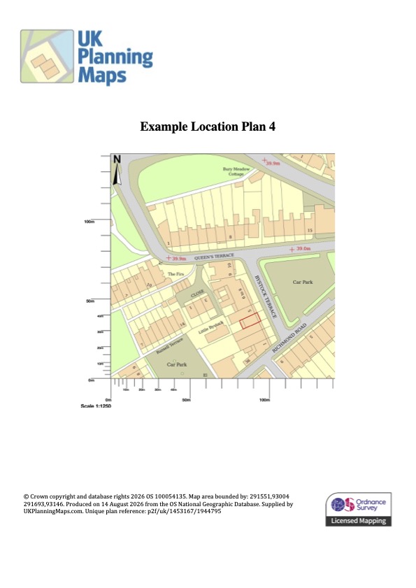
A good location plan should make the application site easy to find and clearly show which land is included in the planning application.
The plan should normally show the site outlined in red, sufficient surrounding roads or buildings, the direction of north and the scale of the map.
On this page, we look at examples of acceptable location plans and some of the most common mistakes that can delay a planning application.
Get your Location Plan Location Plan Guide
Need a location plan?
Create your plan online using current Ordnance Survey mapping.
- Location plans from £13
- Trade location plans from £11.05
- 15% off every product for Trade Account customers
- Preview your plan before ordering
- Add red and blue boundaries online
- Download your PDF immediately
For full instructions, read our guide to getting a location plan.
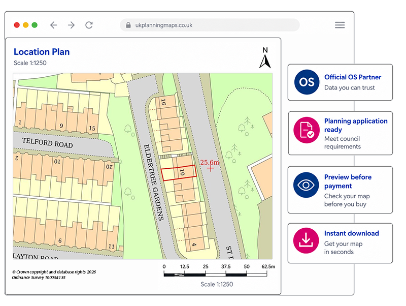
Example 1: Location plan for a house extension
This example shows a normal residential property at 1:1,250 scale.
The red line follows the boundary of the whole property, rather than being drawn tightly around the proposed extension.
The plan also shows:
- The house
- Front and rear gardens
- The driveway
- Access to the road
- Nearby houses
- Named roads
- The north arrow
- The scale bar
For most house extensions, the application site is the whole residential property.
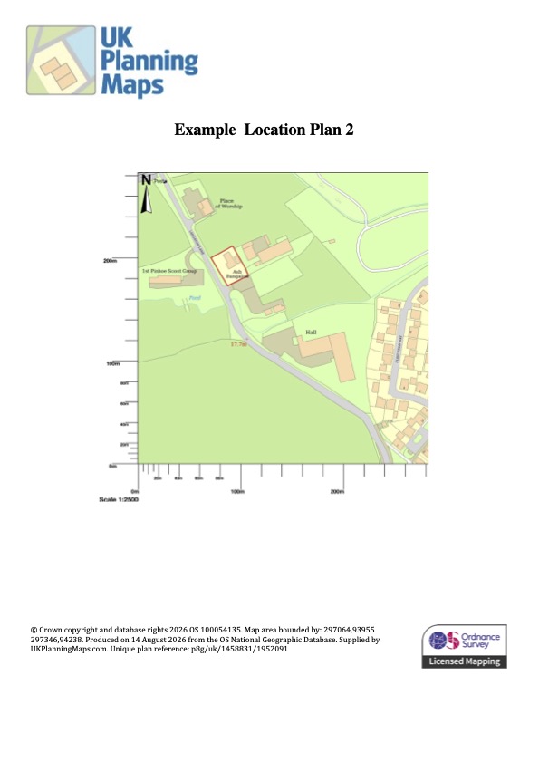
Example 2: Location plan for a rural site
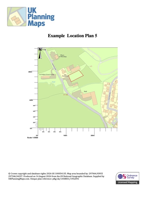
A larger rural site may need to be shown at 1:2,500 scale.
This example includes:
- The proposed development site
- The access track
- The connection to the public road
- Nearby buildings
- A recognisable road or landmark
- The complete red boundary
The long access is included because it is needed to reach the development site.
When preparing a rural location plan, check that the access is not cut off by the edge of the map.
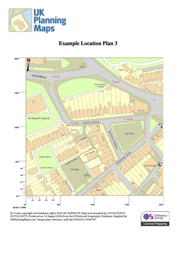
Example 3: Red and blue boundaries
The red line identifies the land included in the application.
The blue line identifies other nearby or adjoining land owned by the applicant which is not part of the application site.
A blue line may be needed where the applicant owns:
- An adjoining field
- A separate garage plot
- A neighbouring property
- Another part of a larger estate
- Nearby woodland
There may be no blue boundary, one blue boundary or several separate blue boundaries.
Example 4: Red line drawn too tightly
In this example, the red line has been drawn only around the proposed extension.
This may not identify the application site properly.
For a normal house extension, the red line will usually follow the boundary of the whole residential property, including its garden and access.
The detailed position of the extension is normally shown on the block plan and other drawings.
Example 5: Access omitted from the red line
This example shows the development area but leaves out the access track connecting it to the public road.
Land required to reach or carry out the development may need to be included within the red boundary.
This can include:
- Driveways
- Shared access roads
- Farm tracks
- Parking
- Turning areas
- Visibility splays
Read our red line boundary guide for more examples.
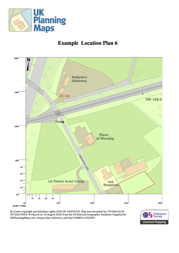
Example 6: Not enough surrounding detail
The property is visible, but there is not enough surrounding information to locate it easily.
Where possible, a location plan should show two named roads. Where this is not possible, a named road and a recognisable landmark may help.
A plan may need a different scale or a larger paper size if:
- The site is close to the map edge
- Part of the red line is cropped
- The access is missing
- No named roads are visible
- The site cannot be identified without another map
Example 7: Incorrectly printed plan
A digital location plan may be correctly prepared but become inaccurate when it is printed.
When printing your plan:
- Select Actual Size or 100%
- Do not select Fit to Page
- Do not select Shrink to Fit
- Check the printed scale bar with a ruler
Changing the size of the PDF changes the printed scale.
Acceptable location-plan checklist
Before submitting your plan, check that:
- The complete site is visible.
- The red line is continuous and easy to see.
- The site access is included where relevant.
- Other nearby land owned by the applicant is shown in blue where required.
- The scale is clearly marked.
- The north arrow is visible.
- The plan shows enough surrounding roads or buildings.
- The site is not too close to the edge of the page.
- The map includes the correct Ordnance Survey licence information.
- The boundary is consistent with the application form and block plan.
Local Planning Authorities can have additional validation requirements. Check the relevant council’s local validation list before submitting the application.
Create your location plan
UK Planning Maps makes it easy to find the site, select the correct scale and add the required boundaries.
- Standard location plans from £13
- Trade location plans from £11.05
- Current Ordnance Survey mapping
- Instant PDF download
- Printed copies available
- Telephone help available
No postcode? Use our Advanced Search.
Need help? Call 01856 898 022.
Example Location Plan - House Extension
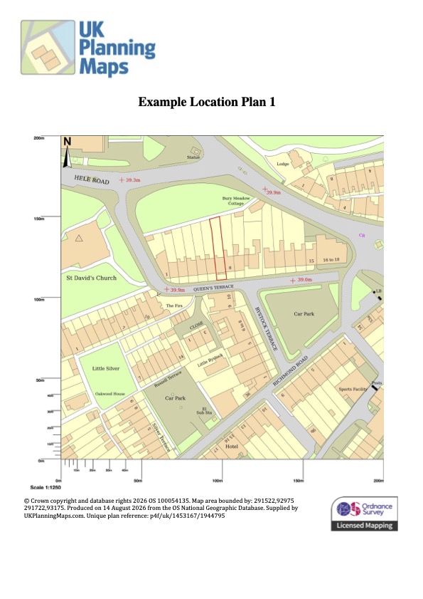
Example of Red Line Boundary
Frequently Asked Questions
Ready to Get Your Location Plan?
Every plan is instantly downloadable, Planning Portal‑compliant, and includes all required elements. Get your plan now and submit your application with confidence.