
Why Google Maps Isn’t Suitable for Planning Application Maps
You can find your house on Google Maps in seconds. The road is labelled, the building is visible and, in satellite view, you can even see the garden. Taking a screenshot, drawing a red line around it and sending it with your planning application might seem a sensible shortcut.
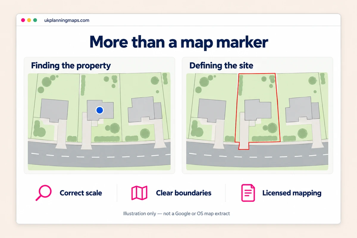
The difficulty is that finding a property is not the same as preparing a planning application map. The council needs a clear, properly scaled plan showing exactly which land the application covers. A screenshot taken for directions rarely provides that information in the right form.
Can you use Google Maps for a planning application?
Don’t rely on Google Maps as a replacement for the required location plan or site plan. Some councils expressly rule it out. Basingstoke and Deane Borough Council, for example, lists Google Maps among the plans it does not accept when checking applications.
That is different from saying every Google image is banned from every planning document. An appropriately permitted image might help illustrate a supporting statement, but it does not replace the required drawings.
Planning requirements vary by application type and across the UK. The national requirements discussed below relate to England. If you are applying in Wales, Scotland or Northern Ireland, use the guidance for that nation and council.
A screenshot does not establish the correct scale
The size of a map on your screen depends on the zoom level, browser window and device. Once you paste that image into Word or resize it to fit a page, its printed size changes again.
Writing “1:1250” underneath it does not make it a 1:1250 location plan.
At that scale, 10 metres on the ground should measure 8 millimetres on the printed page. The drawing needs to be prepared and checked at its stated scale and paper size, rather than adjusted until it looks about right.
A visible on-screen scale bar can help with interpreting distance, but it does not by itself establish the required printed ratio. Saving the screenshot as a PDF does not solve that problem either.
Government planning guidance for England requires drawings at an identified scale and plans showing north. It gives 1:1250 and 1:2500 as typical location-plan scales. A linear scale bar is also useful, particularly for electronic submissions.
A map pin does not show the application boundary
A Google Maps pin points to a place. It does not identify the full area covered by a proposal.
For an extension, that might include more than the patch where the new building will stand. For a new access, it may involve a driveway or land connecting the site to the public highway.
In England, the location plan’s red line should include all land needed to carry out the development. Other land owned by the applicant, close to or adjoining the application site, should be outlined in blue. These distinctions are set out in the same government guidance.
You can draw a line over an image, but the underlying detail still needs to make its position clear. A thick outline across a blurred hedge or roof edge can leave the reader guessing.
Neither a Google image nor an OS map determines legal ownership. Your application boundary should reflect the proposal and the relevant land information, not an assumption based on what looks like the edge of a garden.
Satellite imagery is not a detailed site plan
An aerial photograph can be helpful for getting your bearings. It can also hide things that matter.
Trees may cover a side passage. Shadows may conceal an outbuilding. A roof can overhang the wall beneath it. A fence visible in one image may be difficult to distinguish in another. Tilting into a 3D view makes the picture more familiar, but does not turn it into a measured plan.
The imagery is not necessarily current either. Google explains that its Earth imagery is collected over time and is not live. A recent extension, demolished garage or altered entrance may therefore be missing.
No mapping source should be assumed to show every recent site change. Check your planning map against the property, and arrange suitable survey work where the proposal depends on exact dimensions, levels or positions.
Google’s copyright rules still apply
Being free to view does not mean a map is free to reuse without conditions.
Google’s terms and Geo Guidelines allow certain uses of Google Maps content, including some printed uses and annotations. It would therefore be wrong to say that taking or using any Google Maps screenshot is automatically unlawful.
The permitted use and required attribution still matter. Do not crop off Google’s credits or assume that permission to view a map covers every way of copying, sharing or publishing it. Different Google products and imagery types have different conditions.
There are two separate checks: whether you have permission to use the image, and whether the drawing meets the council’s requirements. Passing one does not mean you have passed the other.
Using appropriately licensed planning maps makes the source and permitted use clearer. Keep the supplied copyright and licence information with your plan.
A location plan and a site plan do different jobs
A location plan places the application site within the surrounding area. Nearby roads and buildings help someone who has never visited find it.
A site plan, often called a block plan, gives a closer view. Depending on the application, it may need to show existing and proposed buildings, access, parking, boundaries, trees and other relevant features.
Site plans commonly use 1:200 or 1:500. Buckinghamshire Council’s guidance gives these scales and explains the detail expected. Always check your own authority’s list.
One tightly cropped screenshot is unlikely to explain both the wider location and the detailed proposal. Buying a site plan also does not automatically add your proposed extension: agree who will prepare those drawings before submitting.
Could the wrong map delay your application?
Yes. A council may ask for a replacement plan before it can validate the application. That means finding the right map, checking the boundaries again and supplying another document when you thought the paperwork was finished.
This is not the same as refusing planning permission because the proposal is unacceptable. It is a problem with the information supplied. Basingstoke’s guidance identifies unsuitable maps and screenshots among the issues applicants should avoid when submitting their plans.
What should you use instead of Google Maps?
Use a properly prepared plan that meets the receiving authority’s requirements, based on suitable mapping that you are entitled to use. Many councils specify Ordnance Survey mapping in their guidance; do not assume an alternative will be accepted without checking.
UK Planning Maps supplies licensed Ordnance Survey plans with the scale, north arrow and licence information needed for planning use. Choose the product to suit the drawing:
- Location plans at 1:1250 or 1:2500 provide the wider setting.
- Site or block plans at 1:200 or 1:500 provide a closer view.
- Georeferenced DWG and DXF maps give your architect editable mapping for preparing the design.
- Bespoke maps are available where standard coverage or scale does not suit the site.
Our mapping covers Great Britain. If your project is in Northern Ireland, use a provider with the appropriate local coverage.
Check these points before you submit
Before paying for a map, check what your architect or agent is already supplying. You may already have the required location plan in the drawing package.
Then check:
- The whole application site fits within the map area.
- There is enough surrounding detail to identify it.
- Boundaries are clear without covering important features.
- The scale, paper size, north point and any required scale bar are correct.
- Proposed works and other requested details have been added where needed.
- You have permission to use and submit the mapping.
Open the final PDF separately and check it again. If printing, use the intended paper size and “Actual size” or 100%, not “Fit to page”.
Our sister website’s planning authority directory helps you find the council’s own guidance. Follow through to its current checklist for your application type.
Google Maps is useful for finding the property and discussing where it is. For the application itself, start with the right planning map and add the information the proposal needs. That is more useful than spending an evening trying to make a screenshot look like a drawing.
Find your planning map, or call 01856 898 022 if you need help choosing the scale or coverage.
Ready to Get Your OS Plans?
Every plan is instantly downloadable, Planning Portal‑compliant, and includes all required elements. Get your plan now and submit your application with confidence.