
How to Get a Location Plan for Planning (UK Guide 2026)
A simple, clear guide explaining what a location plan is, how to draw red and blue boundaries, and how to download an OS‑licensed, Planning Portal‑compliant plan.
What Is a Location Plan?
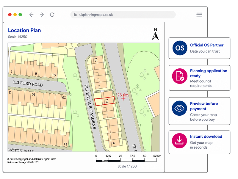
A location plan shows where your site sits in relation to surrounding roads, buildings, and land features. It uses OS base mapping and includes red and blue boundaries so planning officers can understand the site’s context and validate your application.
This guide explains everything you need to create and submit a compliant location plan for your UK planning application.
📘 Planning Portal Requirements for Location Plans
To meet national validation standards, your location plan must include the following:
-
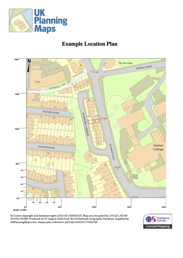
OS base mapping — All location plans must use current Ordnance Survey mapping at the correct scale.
-
Red boundary — This must clearly outline the full extent of the application site, including access.
-
Blue boundary — Shows any additional land owned by the applicant but not included in the application.
-
North arrow — Required for orientation and validation.
-
Scale bar — Must be present and readable.
-
Correct scale (1:1250 or 1:2500) — Planning officers will reject plans at incorrect scales.
-
OS licence number — Required to show the mapping is legally licensed.
-
Surrounding roads and buildings — Must be visible and clearly identifiable.
📘 What UK Planning Maps Includes Automatically
Every plan you download from us already includes:
-
North arrow
-
Scale bar
-
OS licence number
-
Red & blue boundaries
-
Correct OS mapping
-
Instant PDF output
This ensures your plan meets Planning Portal validation requirements without any extra work.
Example Location Plan
How to Draw the Red Line Boundary
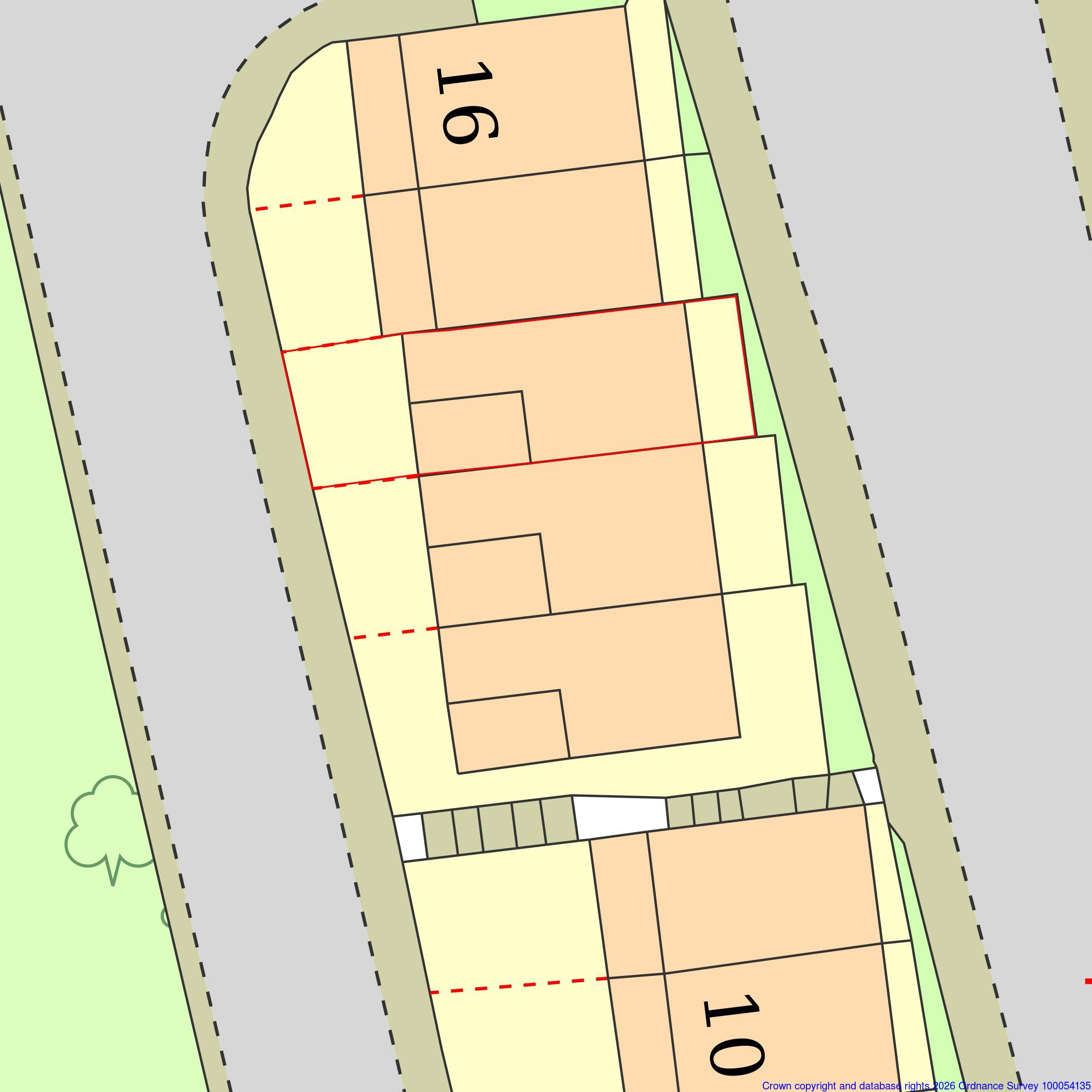
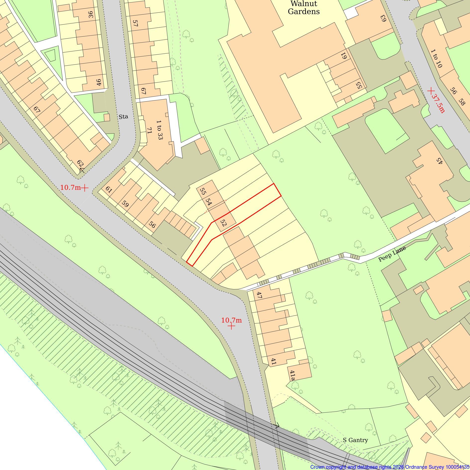
The red line boundary must follow the exact legal boundary of the development site and include all land needed for access, visibility splays, and works. It should be a clear, unbroken line that accurately outlines the area you are applying for.
The blue boundary shows any additional land owned by the applicant but not included in the planning application.
For more detail, see our full Red Line Boundary Guide.
Common Validation Mistakes
Most planning applications are delayed because of simple errors in the location plan. Check these before submitting:
Incorrect Scale
Plans must be drawn at 1:1250 or 1:2500. Using the wrong scale leads to rejection.
Incomplete Boundaries
Ensure the red line fully encloses the site and includes access routes.
Outdated Mapping
Always use current OS mapping. Old maps can cause validation failure.
Missing Elements
Every plan must include a north arrow, scale bar, and OS licence number.
Example of Red Line Boundary
Frequently Asked Questions
Ready to Get Your Location Plan?
Every plan is instantly downloadable, Planning Portal‑compliant, and includes all required elements. Get your plan now and submit your application with confidence.