
Find your OS CAD Map
advanced searchShapefiles now Free
We now offer free shapefiles with all purchases at UK Planning Maps. For more information please see our shapefile information page.
Trade Accounts
We offer Trade Accounts to customers who regularly order 5 or more maps a month.
With a Trade Account you automatically receive a 15% discount on all orders.
There is no standing charge for our Trade Accounts.
For more information please see our Trade Account Page
Ordnance Survey CAD Mapping
Our Ordnance Survey CAD mapping is delivered to you instantly in fully layered editable files. Both the DWG (for Autocad) and the DXF files offer the same high level of data.
Our DWG and DXF OS Maps use the best quality Mastermap® data set, at the best prices online. We offer a free preview of your Mastermap® each before purchase.
| File Format | DWG suitable for CAD programs |
|---|---|
| Data Set | Ordnance Survey Mastermap |
| Scale | Vector File - is completely scaleable |
| Additional Features | North Arrow, Scale Bar |
| Georeference | Ordnance Survey Eastings And Northings |
| Licence Information | Ordnance Survey Licence Number, Unique Plan Reference |
| Delivery | File sent instantly by Email |
| Area Covered | from 100m x 100m |
| Contour Height Data | Ordnance Survey Contour lines at 5m intervals for a small additional charge |
| Additional Height Data | Digital Terrain Model available from £15 |
| Price | from £13.60 |
Our DWG and DXF OS Maps use the best quality Mastermap® data set, at the best prices online. We offer a free preview of your Mastermap® each before purchase.
| File Format | DXF suitable for CAD software |
|---|---|
| Data Set | Ordnance Survey Mastermap |
| Scale | Vector File - is completely scaleable |
| Additional Features | North Arrow, Scale Bar |
| Georeference | Ordnance Survey Eastings And Northings |
| Licence Information | Ordnance Survey Licence Number, Unique Plan Referrence |
| Delivery | File sent instantly by Email |
| Area Covered | from 100m x 100m |
| Free Height Data | Ordnance Survey Contour lines at 5m intervals |
| Additional Height Data | Digital Terrain Model available from £15 |
| Price | from £13.60 |
Prices and Samples
| samples | price | ||
|---|---|---|---|
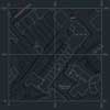 |
OS CAD Map 1 Hectare 100m x 100m |
£16 | |
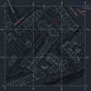 |
OS CAD Map 2 Hectares 141.42m x 141.42m |
£25 | |
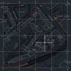 |
OS CAD Map 4 Hectares 200m x 200m |
£51 | |
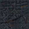 |
OS CAD Map 10 Hectares 316m x 316m |
£121 | |
|
OS CAD Map 20 Hectares 447m x 447m |
£190 | |
|
OS CAD Map 50 Hectares 447m x 447m |
£265 | |
|
OS CAD Map 100 Hectares 1000m x 1000m |
£360 | |
|
Digital Terrain Model priced per hectare |
£15 |