
Choosing a Planning Permission Map for Your Application
A planning application can be delayed over something as simple as an unclear red line. Your drawings may explain the proposed extension or new dwelling perfectly, but the planning authority also needs to see exactly where the site sits and what land is included. That is the job of a planning permission map.
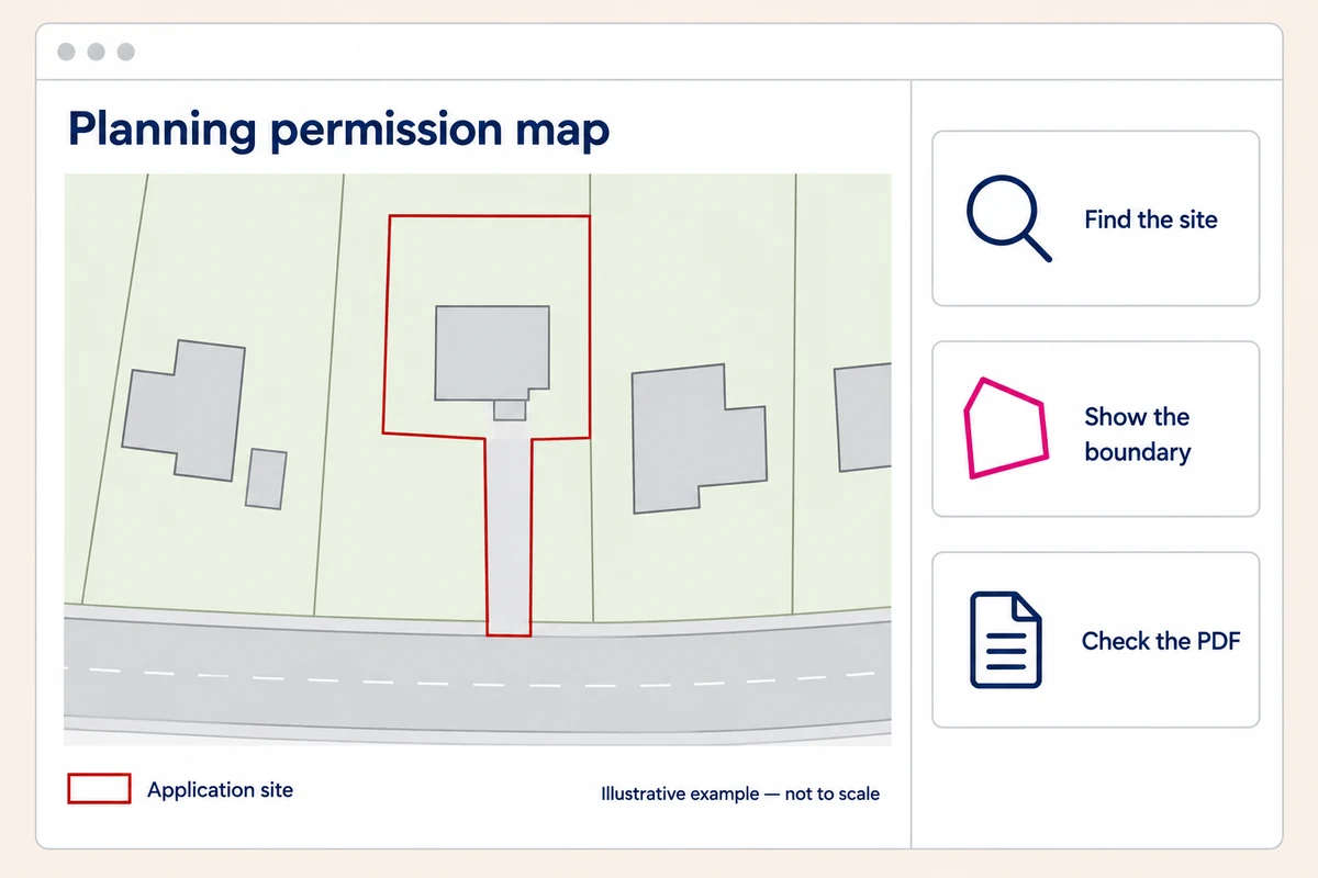
What is a planning permission map?
The phrase “planning permission map” usually means a map submitted with a planning application. It does not mean a map showing where permission has already been granted, and buying one does not establish whether your project needs permission.
For an extension, a new home or a change of use, your council may need a location plan and a more detailed site or block plan. These sit alongside drawings and documents explaining the proposal.
If you are unsure which application route applies, try the five-step planning permission starting check on our sister website, Planning Maps UK. It is guidance, not a formal planning decision. Follow up with the requirements for your UK nation and your local authority.
It also helps to separate validation from approval. Validation means the authority has the information needed to process the application. It does not mean the development is acceptable or that permission will follow.
The maps most planning applications require
Before ordering, check your council’s current validation checklist and agree what your architect, designer or agent will supply. Also check what your chosen submission service already includes. This avoids paying twice for the same plan.
A short message to your designer can settle this: “Which plans are included in your fee, which base maps should I order, and will you prepare the final submission PDFs?” Keep their reply with the project paperwork so everyone is working to the same brief.
Location plan: usually 1:1250 or 1:2500
A location plan places the application site in its wider surroundings. Roads, neighbouring buildings and other recognisable features help the planning officer find it without guessing from the address.
The red application boundary needs to fit within that context. A tightly cropped property outline with almost nothing around it may not explain the location clearly enough. Our location plan examples show the sort of surrounding detail these plans provide.
Site plan or block plan: often 1:200 or 1:500
A site plan gives a closer view of the site and its relationship with neighbouring land. Depending on the proposal, it may need to show buildings, access, parking, trees and the position of the proposed development.
A purchased base map does not automatically include your proposed extension or new building. You or your designer must add the relevant information. See our block plan guide if the terminology on your checklist is unclear.
Choosing the correct scale
Scale is a balance between detail and coverage. At the same paper size, 1:200 shows features larger than 1:500 but covers less ground. Similarly, 1:2500 covers more surrounding land than 1:1250.
Start with any scale specified by the council, then check whether the necessary area fits. A postcode or an “urban” or “rural” label is not enough to decide this on its own.
Imagine a house at the end of a long drive. A close view may show the house perfectly but leave out the connection to the road. You need coverage that explains the relevant access, not just the building.
Now imagine a new house proposed in part of a large garden. The location plan must identify the application site; the detailed plan must explain the new building’s position, access and relationship with the existing house. Enlarging one map will not necessarily answer both questions.
Check the stated paper size too. A PDF prepared for A4 will not retain its stated printed scale if it is reduced using “fit to page”. A scale bar is a useful check, but it does not replace the council’s requirements.
For a simple comparison, one centimetre represents two metres at 1:200, five metres at 1:500 and 12.5 metres at 1:1250, when printed at the correct size. This explains why a location plan is useful for context but less useful for showing the detail of a small extension.
Why licensed Ordnance Survey mapping matters
Planning officers need clear, appropriately licensed mapping. A screenshot from an ordinary online map may have unsuitable detail, no dependable printed scale and restrictions on reuse.
UK Planning Maps supplies licensed Ordnance Survey mapping for Great Britain, including detailed OS MasterMap data. Keep the copyright and licence information supplied with your map visible when preparing the final drawing.
Current mapping is a useful base, not a substitute for checking the site. Recent alterations may not yet appear, and mapped features do not establish a legal ownership boundary. Ordnance Survey explains this in its land boundaries guidance. Design-critical dimensions and levels may require a measured survey.
For Northern Ireland, check the appropriate mapping source and the receiving authority’s requirements rather than assuming an Ordnance Survey Great Britain product applies.
How to mark your boundaries correctly
In England, the red line should include all land necessary to carry out the proposed development. Depending on the project, that can include access, parking and other supporting land, not simply the footprint of the new work. The government’s plans and drawings guidance explains this requirement.
Do not leave necessary access outside the application boundary merely because someone else owns it. Equally, a red line is not proof that you own everything inside it. Ask your agent or council how the boundary, ownership certificates and required notices should be handled. Including land in your application does not grant a right to use it.
Under that guidance, a blue line identifies other land owned by the applicant close to or adjoining the application site. It should not be used simply because you occupy or control land that somebody else owns.
Keep the lines clear enough to follow without hiding important map detail. Our guides to drawing a red line boundary and blue planning boundaries explain the distinction. Check the applicable national guidance and your authority’s instructions before submission.
Creating a planning map without slowing down your application
Find the property using its postcode, or use Advanced Search where there is no suitable postcode. Position the map, choose the required scale and add the boundary where needed.
Before placing the order, make three checks:
- Purpose: are you buying the location plan, the detailed site plan or both?
- Coverage: are the relevant site, access and enough surrounding features visible?
- Handover: who will add the proposal, and what file format do they need?
After downloading, open the actual PDF. Check the address, scale, north point and boundary, rather than relying only on the ordering preview. If your designer adds information, repeat the check on the final exported drawing.
View the whole page first, then zoom in. Look for clipped labels, a boundary hidden beneath other annotations and notes that become unreadable at normal size. Check that any rotation of the drawing has not left the north point showing the wrong direction.
One customer, Mr Wellden, described a useful reason for doing this: “Red outline drawn did not appear on first map, online chat sorted that.” His review appears on the UK Planning Maps homepage. That is exactly the sort of problem worth catching before you upload your application.
Common mistakes that cause avoidable queries
If the council asks for a replacement plan, first establish what is missing. A request for more surrounding context is different from a request for dimensions or a clearer proposed layout. Ordering another base map will not fix missing design information.
Ask which drawing needs changing and what it must show. Then agree with your designer whether the answer is different coverage, an amended boundary or additional proposal detail. Keep the application boundary consistent across the revised drawings.
Before resubmitting, remove superseded versions from the upload selection and check that filenames and revision references identify the correct documents. A clear replacement pack saves the reviewer having to work out which plan you intended to use.
Keep your original files separately rather than deleting the record of what was sent. In your reply, identify the amended drawing and briefly explain the change, such as “location plan revised to show the full access”. Follow any naming or upload instructions the council provides.
Ready to begin? Find your planning permission map, or call 01856 898 022 if you need help choosing the mapping.
Ready to Get Your OS Plans?
Every plan is instantly downloadable, Planning Portal‑compliant, and includes all required elements. Get your plan now and submit your application with confidence.