
Ordnance Survey MasterMap for Planning Maps
If you have been asked for an Ordnance Survey MasterMap planning map, you may be wondering exactly what to buy. The name describes the mapping behind the plan, not a separate type of planning application. This guide explains what that mapping gives you, how to choose a useful scale and format, and what you or your designer may still need to add.
If you have been asked for an Ordnance Survey MasterMap planning map, you may be wondering exactly what to buy. The name describes the mapping behind the plan, not a separate type of planning application. This guide explains what that mapping gives you, how to choose a useful scale and format, and what you or your designer may still need to add.
What is Ordnance Survey MasterMap?
For the planning maps discussed here, the relevant product is OS MasterMap Topography Layer. It records features such as buildings, roads, paths, water and areas of land as digital points, lines and shapes, with information describing them. Its coverage is Great Britain: England, Scotland and Wales, not Northern Ireland.
It is more than a picture of a neighbourhood. The underlying vector data can be presented as a printable map or supplied in formats that a designer can work with. You do not need to understand the database to order a location plan, but the distinction helps explain why the same source can support several products. OS explains the Topography Layer here.
MasterMap is maintained over time. OS publishes the product every six weeks, but that does not mean every property has been checked during those six weeks. Its revision policy uses different update programmes for different changes. A newly downloaded map is not a new survey of your site.
Why MasterMap mapping is used for planning applications
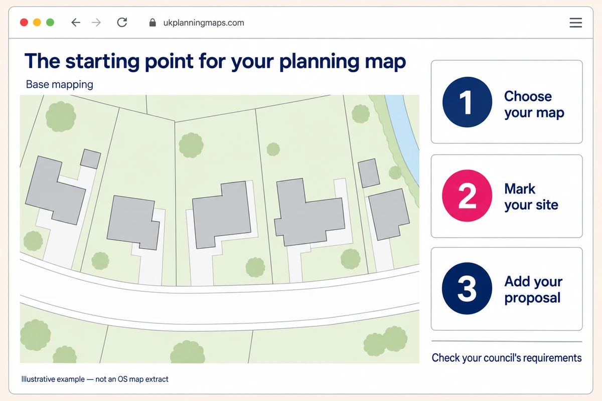
A planning officer needs to place your proposal in its surroundings. Detailed mapping provides that context: the house beside yours, the road serving the site and the relationship between buildings and open land.
However, the base map and the proposed development are different things. Ordering a site plan does not automatically add your extension, parking layout or new entrance. Agree who will prepare those details before you order.
| On the base map | Your next check |
|---|---|
| Mapped building outlines | Does the existing layout match the site, and has the proposal been added separately? |
| Roads and surrounding features | Is there enough coverage to explain access and identify the property? |
| Physical boundary features | Have you checked the application extent rather than assumed the map proves ownership? |
That last distinction matters. OS mapping shows physical features, not legal property boundaries. It cannot settle an ownership dispute. Where accurate dimensions or levels are needed for design work, ask your designer whether a measured site survey is required.
Choosing the right planning map scale
Start with the job the plan must do, then check the requirements for your application and UK nation. The following are common planning scales, not a guarantee that one sheet will suit every site.
Location plans at 1:1250 or 1:2500
A location plan shows where the application site sits within the surrounding area. Government guidance for England gives 1:1250 and 1:2500 as typical scales.
At the same paper size, 1:2500 shows a wider area than 1:1250. That can help with a larger or rural site. Choose coverage that makes the location understandable, rather than centring tightly on the building and losing the road that identifies it.
Site and block plans at 1:500 or 1:200
A site or block plan shows the development in relation to the site itself. The Planning Portal describes 1:200 and 1:500 as typical site plan scales. A smaller site may fit comfortably at 1:200; 1:500 provides more coverage on the same sheet.
A larger printed scale does not make the underlying mapping more accurate. Printing at 1:200 enlarges the presentation; it does not turn the data into a measured 1:200 survey.
Before ordering, ask your designer to confirm three things: the plan type, the area to include and the intended paper size. If an access track continues beyond the chosen map, resolve the coverage before paying.
For example, a garden plot might need nearby houses on its location plan, while its detailed site plan needs room for the proposed building, parking and the route to the road. The two sheets explain different things. Buying the same tightly cropped area at two scales may not give you either view properly.
Marking boundaries and annotations clearly
The red application boundary is an annotation you add, not something MasterMap decides for you. In England, the red line should enclose all land needed for the development, including relevant access. A blue line identifies other land owned by the applicant nearby or adjoining the site.
Draw carefully enough that the underlying detail remains readable. A thick line can hide a narrow path or make it unclear which side of a fence you mean. Check the downloaded plan at its intended viewing size, not just while zoomed in.
Keep proposed work visually distinct from existing mapping. Clear labels such as “proposed extension” are more useful than an unexplained coloured shape. Do not treat the base map's colours as ownership information or assume every supplier uses identical styling. OS provides a standard styling specification, but a supplier's PDF or CAD presentation may differ.
Help with these practical details can make a difference. In a customer review, S P George described how Evelyn helped by drawing boundary lines and adding a road name for a rural site. If you cannot place a boundary or label clearly, get in touch before finishing your order.
PDF, CAD and digital MasterMap files
Choose PDF if you need a prepared page to check, share or print. It is often the simplest option when your designer only needs a location plan, or is adding proposal details separately.
Choose CAD when someone needs editable mapping for their drawing software. Our DWG and DXF maps are layered and georeferenced using OS eastings and northings. Confirm which format and file version your designer needs rather than assuming either will work in every program.
Georeferencing gives the mapping a geographic position. It does not guarantee automatic alignment with a survey drawn around a local origin, or make every mapped feature survey-accurate. Ask the person combining the files to check the coordinate system, units and alignment before drawing over them.
Keep an untouched copy of the supplied CAD file. Put proposed work on separate layers, and check the exported PDF independently before it goes into the application.
If the project needs contours, ground levels or building heights, confirm exactly which height data the chosen product includes. These are not interchangeable, and ordinary base mapping is not a detailed levels survey.
Licensing is part of getting the map right
Use mapping licensed for the purpose you have in mind. Finding a useful-looking extract online does not automatically give you permission to copy it into an application. Our preview maps are for use within the ordering service, not substitutes for purchased plans.
Keep the supplied copyright acknowledgements, licence information and plan reference visible. If you place the map inside a larger drawing sheet, check that these have not been cropped away.
Read the terms supplied with your particular product, especially if you intend to share editable data or use it for another project. Our website terms note that additional product terms may apply. Ask us if you are unsure; do not assume every PDF, printed plan and CAD licence works identically.
A practical check before you submit
Open the actual file you intend to upload and work through these checks:
- The property is correct and relevant surrounding detail is visible.
- The application boundary agrees with the other drawings.
- Any required proposed development has been added and labelled.
- The north point, stated scale and licence details are readable.
- The file type, paper size and drawing reference meet the receiving authority's instructions.
Our sister website, Planning Maps UK, has a planning map checklist you can use alongside the council's own guidance. It is a useful final review, not a replacement for application-specific requirements.
If a recent building or other important feature appears to be missing, raise it before submission. Do not quietly redraw the source mapping and assume the issue is resolved.
Printing a copy? Use the intended paper size and select “Actual size” or 100%, checking that nothing is cut off. A “Fit” setting can change the printed scale. Adobe explains the printing options. Keep the original PDF for submission rather than replacing it with a screenshot.
Ready to choose your map? Find your planning map, or call 01856 898 022 for help with the options. A well-prepared map supports the application; it does not guarantee planning permission.
Ready to Get Your OS Plans?
Every plan is instantly downloadable, Planning Portal‑compliant, and includes all required elements. Get your plan now and submit your application with confidence.