
Council Map Acceptance for Planning Applications
A council query about your planning map can be frustrating, especially when you thought everything was ready to submit. Often, the first job is to find out exactly what needs changing. This guide explains what council map acceptance means, which plans are usually needed and how to check the details that can hold up an application before sending a clear replacement.
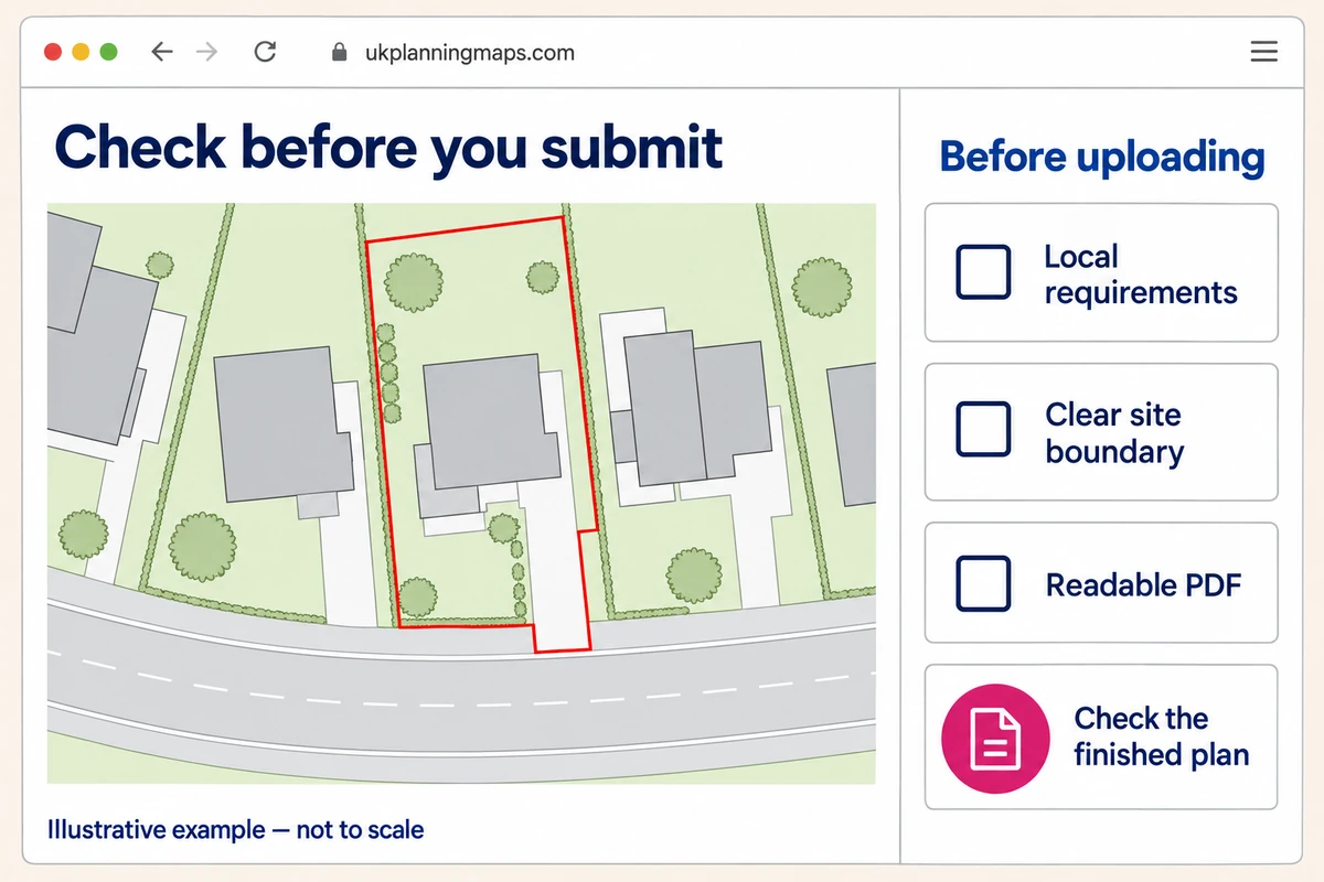
A council query about your planning map can be frustrating, especially when you thought everything was ready to submit. Often, the first job is to find out exactly what needs changing. This guide explains what council map acceptance means, which plans are usually needed and how to check the details that can hold up an application before sending a clear replacement.
What council map acceptance usually means
When people ask whether a council will accept their map, they are usually asking whether it provides the information needed to validate their application. That is different from deciding whether the development should receive planning permission.
A readable, correctly prepared plan helps the council understand the site and the proposal. It does not settle questions about design, neighbours, planning policy or whether permission should be granted.
Start by reading the actual message from the council. Does it say the application is invalid because information is missing? Is the officer asking for clarification during assessment? Or has a formal decision been issued? These are different situations, and ordering another map will not necessarily address the issue.
The practical advice below is useful across the UK, but planning procedures and document requirements vary between nations and authorities. Use the guidance for your own council and application type. A householder checklist may not cover a change of use, a new dwelling or a different consent.
If the wording is unclear, ask which drawing is affected and what information is needed. A specific answer is more useful than trying to guess what “please provide a suitable plan” means.
A later request for information does not automatically mean the original map failed validation. Scottish Government guidance, for example, distinguishes the information needed for a valid application from additional information needed to determine it. Keep that distinction in mind when discussing the next step with your officer.
The plans most planning applications need
A location plan identifies the site within the surrounding area. A site plan, often called a block plan, shows more detail within and around the property. They serve different purposes; enlarging the location plan does not automatically produce a suitable site plan.
The Planning Portal’s explanation of location and site plans gives typical scales of 1:1250 or 1:2500 for location plans and 1:200 or 1:500 for site plans. Choose the coverage and scale that make your particular site clear, following the receiving authority’s instructions.
For applications in England, national planning guidance says plans must identify their scale and show north. The red line should include all land needed for the development, including necessary access. Other land owned by the applicant close to or adjoining the application site should be edged blue.
The red line is therefore not simply a line around everything you own. If necessary access crosses someone else’s land, do not leave it out just to match your ownership. Ask your agent about the appropriate ownership certificate and notices.
Our licensed OS mapping uses Ordnance Survey MasterMap data as a base for preparing these documents. It does not add the proposed extension, parking arrangement or other design information for you. Agree with your architect or designer who is preparing the finished site plan, rather than assuming the purchased base map completes the drawing.
Why otherwise good maps are rejected
A map can look tidy on screen and still leave an important question unanswered. The problem may be its coverage, an annotation or the final exported file, rather than the underlying mapping.
Check you have permission to use the mapping for your planning application. A map being viewable online does not mean a screenshot is licensed for that purpose. Keep the supplied copyright and licence details on the submitted sheet, and ask the supplier if you are unsure about permitted use.
For example, Carmarthenshire’s validation guidance identifies errors involving north points, scales, red lines and relevant highway access. That is a useful local example, not a substitute for your own authority’s checklist.
| The council’s query | A useful first check |
|---|---|
| The site cannot be identified | Check the address, complete red line and enough surrounding roads or buildings. |
| Access is unclear | Trace the route between the site and the public highway; check the relevant land is shown. |
| The scale is incorrect | Check the exported PDF’s page size against the paper size and scale stated on the drawing. |
| The proposed layout is missing | Check whether you sent only the base map, rather than the completed proposed site plan. |
Also compare the drawings with each other. If the location plan includes an access strip but the proposed layout stops at the front gate, the relationship may need explaining. Keep the address, application boundary and proposal description consistent throughout the set.
Check the physical site too. Buying current mapping does not commission a new measured survey of your property. If a recent change matters to the proposal, discuss how it should be recorded with your designer.
Nor should a mapped fence be treated as proof of ownership. Ordnance Survey explains the distinction between mapped features and legal boundaries. Resolve an ownership uncertainty using the appropriate records and professional advice, not by shifting a line until it looks convenient.
How to improve your chances of council map acceptance
Check the requirements before choosing the map. Use the council guidance finder on our sister website, Planning Maps UK to find an authority, then follow through to its current official planning guidance. The directory is a starting point, not the council’s own advice.
Next, open the file you actually intend to submit. The ordering preview and your designer’s working drawing are useful checks, but neither proves that the finished PDF contains everything.
- Check the whole application site fits on the sheet, with useful surrounding context.
- Make sure the red line remains clear without hiding important map detail.
- Keep the north point, stated scale and supplied copyright and licence information visible.
- Check that existing features and proposed work can be distinguished.
- Confirm the filename, drawing reference and revision identify the correct document.
Page size deserves particular attention. Torbay’s guidance on scaled drawings explains that the PDF page size must match the original drawing. If printing, use the intended paper size and “Actual size” or 100%, checking for cropping. “Fit to page” can change the scale.
Keep the original PDF instead of submitting a screenshot. Check the council’s upload formats, size limits and naming instructions. A sensible final test is to ask someone unfamiliar with the project to locate the site and identify the proposed work without an explanation from you.
Before paying for additional plans, check what your designer and application service already provide. The missing item might be an annotation or a revised drawing, rather than another map purchase.
When the council asks for amended plans
Save the council’s request alongside the submitted files. Make a short list matching each query to the drawing that needs attention. If someone else prepared that drawing, send them the exact wording rather than your recollection of it.
Ask how the replacement should be supplied and note any stated deadline. For design changes during an application, speak to the case officer first. Torbay’s amendments guidance, for example, asks for clear revision references and dates and explains its approach to accepting changes.
A brief covering note helps: “Location plan LP01 revision B replaces LP01 revision A. The red line now includes the access identified in your email.” Use that wording only where it accurately describes the agreed correction.
Retain the earlier version for your records, but make the replacement unmistakable. Check linked drawings for the same change and keep a copy of the submission confirmation. Avoid sending several files called “final” with no clear indication of which one supersedes the others.
If the request covers several documents, ask whether the council wants them together. Include a simple list of what you are supplying and which point each item addresses. That makes it easier for the recipient to check your response without searching through a chain of emails.
Our customers sometimes contact us with a council query. In a customer review, p bent described the team answering a question raised by Shropshire Council before invoicing, once the customer was happy. If you need help with a mapping question, send us the council’s exact wording so we can understand what is being asked.
Need mapping for your application? Find your planning map, use Advanced Search if there is no postcode, or call 01856 898 022 for help with the mapping options.
Ready to Get Your OS Plans?
Every plan is instantly downloadable, Planning Portal‑compliant, and includes all required elements. Get your plan now and submit your application with confidence.