
Can I Use Aerial Maps for UK Planning Applications?
An aerial view can explain a property in seconds. You can see the garden behind the house, the track leading to a barn and the trees screening a neighbouring building. So, can I use aerial maps for a planning application? Usually, they work best as supporting information. Keep the location plan and any site or block plan your council requires, then add an aerial image if it helps explain something those drawings do not.
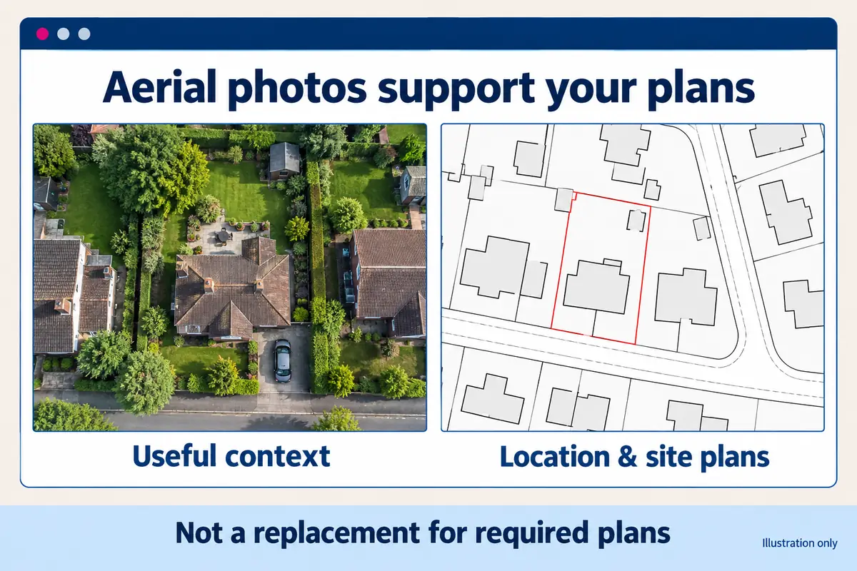
The advice below will help you decide what is worth including. The national planning guidance we refer to applies to England; requirements differ elsewhere in the UK and between application types. Check your own authority's current list before preparing the submission.
When aerial maps are useful for planning
Aerial imagery is useful when someone unfamiliar with the property needs to understand its setting. It can make a long access track, an irregular garden or a group of farm buildings much easier to discuss with your architect or planning adviser.
Start with a question: what does this picture explain? If the answer is simply “it looks nice”, it may not need to go into the application. If it shows how the house sits behind a line of trees, there is a clearer reason to include it.
Imagine a rear extension behind a terraced house. An aerial photograph might help explain the arrangement of neighbouring gardens. The proposed extension's position and dimensions still belong on the appropriate drawings; the photograph does not supply them.
Check when the image was captured, not just when you downloaded it. A new download can show an old shed or miss a recently built extension. Google explains why imagery dates can vary. Trees, shadows and roof overhangs can hide features you need to understand. Compare the image with what is actually on site, and note any relevant changes.
An overhead view also cannot tell you everything about the ground below. Use it to raise questions, not to settle drainage, tree condition or precise measurements without the appropriate information.
Can I use aerial maps instead of a location plan?
For an ordinary planning submission, do not assume that you can replace the location plan with a satellite screenshot. They do different jobs.
England's national planning guidance requires a location plan showing the application site in its surroundings. It describes an up-to-date map, typically at 1:1250 or 1:2500, with enough adjoining roads or buildings to identify the site. Plans must show north and an identified scale.
Adding a red line to a photograph does not automatically provide those things. Labels may be missing, vegetation may conceal the edge you mean, and resizing the image can make a stated scale unreliable. A familiar-looking picture is not necessarily a suitable planning drawing.
That does not mean aerial photography is banned from planning applications. It may be useful supporting material. Professionally prepared aerial mapping is also different from a casual screenshot, but the finished document still needs to meet the authority's requirements for its intended purpose.
Before buying or preparing anything, find your council's planning guidance and follow through to its official validation checklist. Check the correct application type: householder planning permission, prior approval and other routes can have different information requirements. If the council has specifically requested aerial imagery, ask how it should be labelled and submitted.
What a compliant planning map should show
The location plan identifies the land involved. The site or block plan explains the arrangement within it. Aerial context can support that explanation, but it should not leave the officer guessing which document defines the proposal.
For an English planning application, the red line should include all land necessary for the development, including necessary access from a public highway. Other relevant areas may include parking, landscaping or visibility splays. Other land owned by the applicant close to or adjoining the application site should be outlined in blue.
Do not simply trace the garden fence visible in the photograph. The application boundary is about the proposal, not necessarily the whole ownership or the neatest shape on screen. For shared access or land belonging to someone else, get advice on the boundary and ownership certificates; drawing a line does not give you a legal right to use that land.
Site plans are commonly prepared at 1:200 or 1:500, as the Planning Portal explains. Depending on the proposal, they may need existing and proposed buildings, access, parking, trees and boundary treatment. Confirm the details with your designer and council.
Check the saved plan at its intended print size. Can you read the roads, distinguish the boundary and see the surrounding detail? Keep the north arrow, scale and copyright information visible. A scale bar is useful for checking reproduction, but should not be confused with a guarantee that every feature has been surveyed for your project.
Use licensed mapping and check image permissions
Being able to view a map online does not automatically give you permission to copy it into an application. Check the provider's terms for the use you intend, including annotation, submission and any subsequent publication by the council.
There is no single copyright rule covering every aerial-image service. Google, commercial aerial suppliers and open-data providers have their own conditions. Google's usage guidelines distinguish between products and uses. Do not assume that all screenshots are prohibited, or that all publicly viewable images are free to reuse. Keep required attribution and copyright notices intact.
For the formal plans, Ordnance Survey's planning-map guidance explains the importance of obtaining suitable licensed mapping. UK Planning Maps supplies OS-based location and site plans for this purpose. Buying that mapping does not grant permission to copy a separate provider's aerial photography.
If you commission your own aerial photographs, agree what you can do with the finished images. Ask for the capture date and permission for the intended planning use. Keep that information with the project files so nobody has to reconstruct it just before submission.
Choosing the right plan for your proposal
Begin with the documents your council or designer has requested. For the wider setting, our location plans are available at 1:1250 and 1:2500. For closer external detail, our site plans offer 1:200 and 1:500.
These provide the mapping base. Your proposed extension, parking arrangement or other design detail may still need to be added by you or your designer. An aerial image cannot turn an existing-site map into a finished proposed-development drawing.
For a rural property, check that the preview includes the relevant access and enough landmarks to identify the land. If there is no postcode, use Advanced Search. An awkwardly shaped site may need different coverage rather than a tighter crop.
Our PDFs are not georeferenced. If your professional adviser needs editable, georeferenced mapping, ask whether our DWG or DXF files would suit their workflow. Do not buy CAD simply because an aerial viewer uses coordinates; choose the format the person preparing the plans needs.
If you get stuck, ask us. In a review displayed on our website, Mr J Gwilym wrote: “It helped the Council resolve a problem with a planning application.” That is one customer's experience, not a promise about another application. You can read our customer feedback or call 01856 898 022 for help choosing your mapping.
A sensible way to use aerial imagery
Treat the aerial image as an explanation with a clear purpose. Before including it, check:
- Does it add something useful beyond the required plans?
- Have you recorded the source and capture date, if known?
- Do you have permission for the intended use?
- Are relevant changes since the photograph explained?
- Do labels distinguish existing features from anything proposed?
- Is any application boundary consistent with the formal location plan?
- Have you kept attribution visible and the file readable?
A useful caption might say: “Aerial context image showing the relationship between the house, garden and neighbouring buildings.” Add the actual source, date and drawing reference, rather than leaving those details for someone else to guess.
Keep filenames clear too: a location plan, proposed site plan and aerial context image should be easy to tell apart. Use the council's requested upload format and size limits.
The aim is a submission that is straightforward to follow. Get the required plans right first. Then include aerial imagery where it genuinely helps the reader understand your site.
Ready to Get Your OS Plans?
Every plan is instantly downloadable, Planning Portal‑compliant, and includes all required elements. Get your plan now and submit your application with confidence.