
CAD versus PDF: Which Map File Do You Need?
If you're buying a planning map, the choice between CAD and PDF can sound more complicated than it is. Start with one question: what will you do with the file? A PDF is usually the straightforward choice for viewing, printing and submitting a finished plan. CAD is useful when someone needs to work on the mapping. Some projects need both, at different stages.
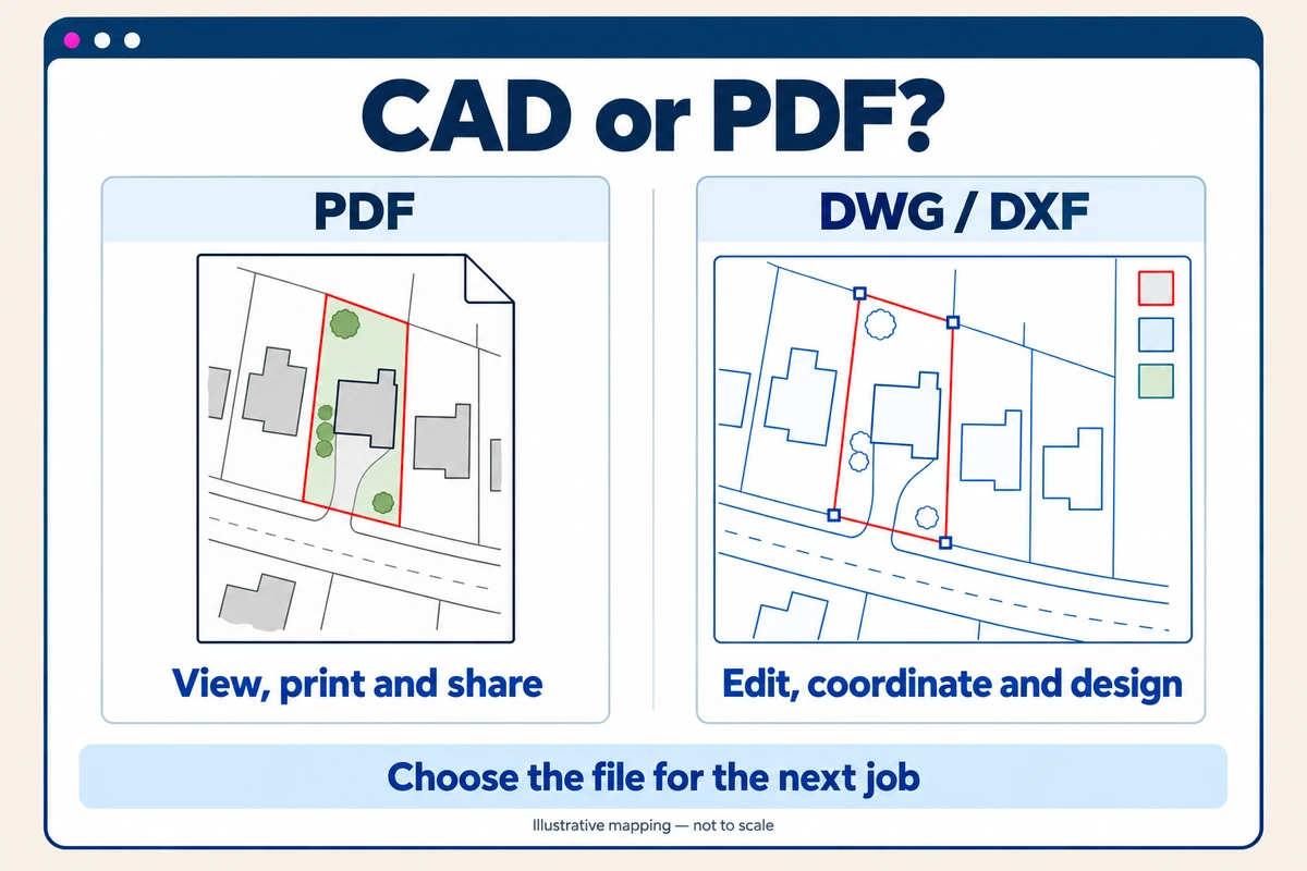
This guide explains CAD versus PDF without assuming you use design software. It also covers the details worth checking before you pay, including georeferencing, printing and who will prepare the final drawings.
CAD versus PDF: the practical difference
CAD stands for computer-aided design. DWG and DXF are common CAD file formats. They give a designer editable drawing elements, rather than just a page to look at. With suitable software, they can work with the linework and layers and add the proposed development.
A PDF holds a prepared page layout. It is convenient to open, email and print without specialist CAD software. That makes it useful when the person receiving the plan needs to read it, not redraw it.
The difference isn't simply “professional versus basic”. A PDF can be a clear, carefully prepared drawing. Equally, buying CAD does not automatically make your application more complete or the underlying mapping more accurate.
There is one important distinction with our products: UK Planning Maps PDFs are not georeferenced. Our DWG and DXF mapping is georeferenced using Ordnance Survey Eastings and Northings. In plain English, the CAD geometry has a real-world position that a designer can use when bringing compatible information together.
That does not mean every imported drawing will line up without checking. Units, coordinates and import settings still matter. A scale printed on a PDF is not the same thing as georeferencing.
When a PDF is the right choice
If you need a location plan to identify your property, and no one needs to edit the underlying mapping, PDF is often all you need. You can check the preview, draw the appropriate boundaries and download the file.
Our location plans are available at 1:1250 and 1:2500. Our site plans, also called block plans, provide a closer view, commonly at 1:200 or 1:500. Choose the plan type and coverage your application needs before choosing the file format.
Be careful with the phrase “ready to submit”. A purchased map of the existing site does not automatically show your proposed extension, new parking spaces or altered access. Those details may still need to be added to the proposed site plan by you or your designer.
PDF is a useful submission format, but not the only one accepted. The Planning Portal's file-format list includes PDF and several alternatives. Its listed CAD format is HPGL (.plt), not DWG or DXF. Do not assume your working CAD file can be uploaded directly; check the route you are using.
Check the scale before you submit
When printing, use the paper size stated on the drawing and select actual size or 100%. “Fit to page” can shrink the plan, even if the printed scale label stays unchanged. Changing the zoom on screen does not change the file's intended print scale.
Open the downloaded PDF and check that:
- The whole application site and necessary surrounding detail are visible.
- The stated scale, scale bar and north arrow are readable.
- Red and blue boundaries, where needed, are clear.
- Labels, drawing information and copyright details have not been cropped.
You can find your council's guidance through our sister website. Follow through to the authority's current requirements, including any upload limits. Planning systems differ across the UK; one portal's rules are not a universal checklist.
When a CAD file is worth buying
CAD becomes useful when the mapping is part of the design work. An architect preparing several extension options, for example, can keep the existing map as a reference and draw each proposal on separate layers.
That is easier to manage than repeatedly drawing over a screenshot. It also gives the designer a working file to revisit when you decide the garage should move or the access needs another look.
For a project involving several consultants, agree the mapped base and coordinate system early. Ask the person importing it to check a known position and dimension before combining it with other information. Keep an untouched copy of the downloaded file so there is something to return to if the working drawing is moved or rescaled accidentally.
Editable mapping still has limits. OS mapping is not a measured survey of every fence, level or recent alteration. It cannot establish an exact legal boundary simply because a line can be selected in CAD. Where the design relies on precise levels or dimensions, ask your professional adviser what site survey is required.
Contour and terrain options may help with some projects, but check what is available and selected when ordering. Do not assume that every CAD file includes the height information needed for detailed drainage or construction design.
CAD needs compatible software and a clear brief
Before buying, send your designer these questions:
- Would you prefer DWG or DXF, and which version can your software open?
- What area should the map cover, including access and neighbouring context?
- What units and coordinate system will the project use?
- Do you need height data or a separate measured survey?
- Who will add the proposal and issue the final PDF?
This is especially useful if you are ordering on someone else's behalf. “Please send a CAD map” is less helpful than a clear format and coverage request. Check the current products, samples and prices together before paying.
Do not treat a converted file as the same thing
Exporting a completed CAD drawing to PDF is a normal way to share the finished sheet. Keep the CAD file for revisions, and use the PDF to show others the issued drawing.
Going the other way is less straightforward. Some PDFs contain vector information that software can import; others contain an image. It would be wrong to say PDFs can never be edited, but importing one does not recreate the original CAD file.
Autodesk's PDF-import guidance explains that objects can be broken into separate elements and information or precision can be lost. Raster images do not become editable map linework just because they have been brought into CAD.
If your designer needs editable mapping, ordering DWG or DXF from the start may avoid unnecessary tracing and checking. Conversion also does not give our non-georeferenced PDF the original CAD coordinates automatically.
Keep the map's licence and attribution requirements in mind when editing or exporting. Changing a file format does not grant extra permission to reuse its contents.
Choosing the format for your project
Think about the next person who will use the file. A homeowner checking a location plan usually needs a PDF. An architect developing a layout may need CAD. A team moving from design to submission will often work in CAD and then issue PDFs; that does not necessarily mean buying the same map twice.
For a rear extension, for example, you might order the PDF location plan yourself while your designer sources the editable mapping for the proposed site layout. Agree this first so you do not duplicate work or miss a required drawing.
At handover, give the final PDF a clear drawing number and revision. Ask the recipient to confirm they have the latest version. A simple filename such as “Proposed-site-plan-rev-B.pdf” is easier to follow than several files called “final”.
If ordering is proving awkward, call 01856 898 022. In a review on our homepage, Rachelle Lewis described misunderstanding the ordering software and being talked through it by phone until the issue was resolved. You do not need to know all the terminology before asking for help.
Choose the format that fits the work, check the preview and agree who will finish the drawings. A suitable map is a useful starting point; the completed application still needs to meet your council's requirements.
Ready to Get Your OS Plans?
Every plan is instantly downloadable, Planning Portal‑compliant, and includes all required elements. Get your plan now and submit your application with confidence.