
Best Conveyancing Plan Formats for UK Property
If your solicitor has asked you for a conveyancing plan, you may be wondering what to order. Is a PDF enough? Do you need a new map, or can you use the title plan you already have? The best conveyancing plan formats depend on the job in hand. Selling a whole property is different from selling part of a garden, granting access or preparing a new lease.
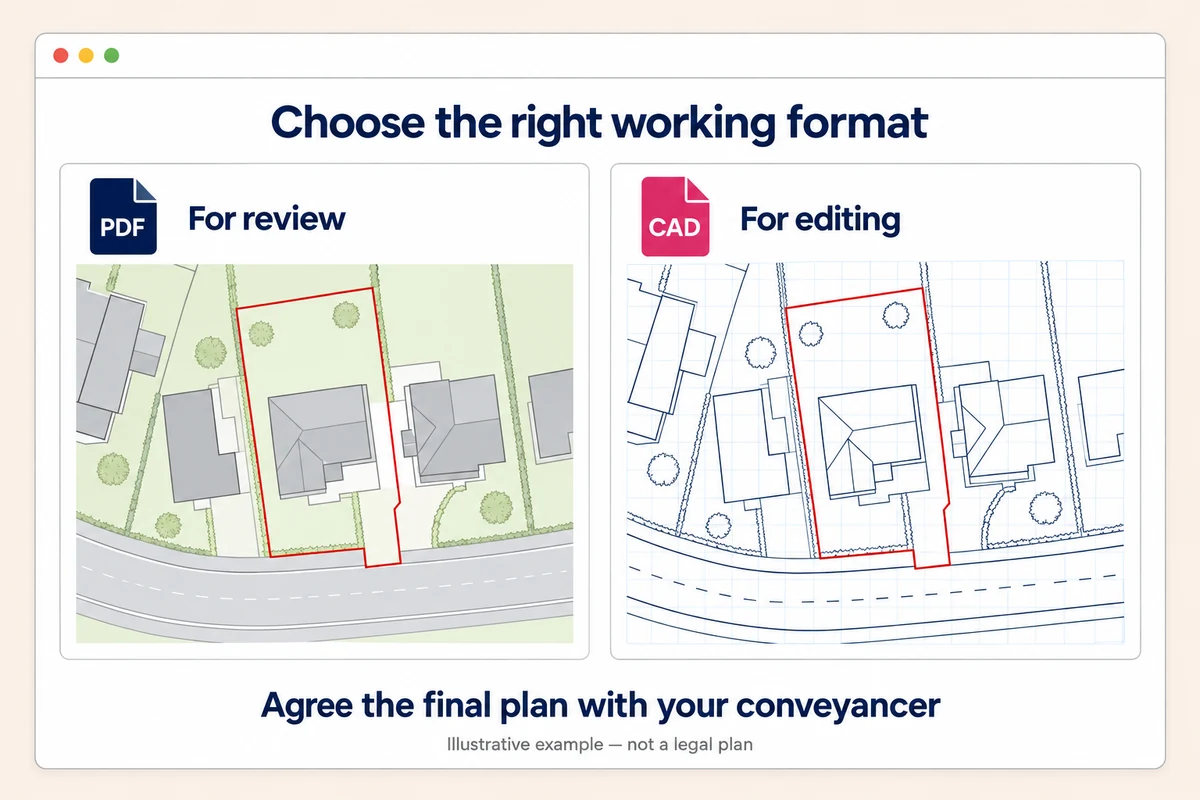
This guide explains the practical choices. References to HM Land Registry apply to England and Wales; Scotland and Northern Ireland have their own registration systems. Before buying anything, ask your conveyancer what they need the plan to show and which documents they already hold.
What makes a conveyancing plan suitable?
A useful plan leaves little room for guesswork. Someone who has never visited the property should be able to locate it and understand which land the transaction concerns.
That means more than choosing a file type. A sharp PDF of the wrong area is still the wrong plan. An impressive CAD drawing is no help if nobody can tell which parking space belongs with the flat.
HM Land Registry’s plan-preparation guidance explains the importance of a clear extent, suitable scale, orientation and surrounding detail. The plan’s markings must agree with the deed.
Start by asking: what is included, what is excluded, and what needs a separate explanation? Resolve uncertainty about the intended transaction with your conveyancer before the plan is attached to documents for signing.
The best conveyancing plan formats by transaction type
The plan’s purpose and its file format are different things. A lease plan describes the property being leased; PDF describes how that plan is supplied.
PDF plans for sales, transfers and Land Registry applications
PDF is often the simplest format for circulating a plan. Clients and solicitors can open it without CAD software, and everyone can review the same page layout.
However, a PDF is not automatically uneditable, correctly scaled or suitable for registration. It can contain crisp linework or a blurred scan. Check the actual file, not just the extension after its name.
For a whole-title sale, your conveyancer may start with the existing register, title plan and relevant deeds. Buying new base mapping does not replace those records. HM Land Registry explains how title plans relate to the register and filed documents.
For electronic submission, follow the receiving service’s requirements. HM Land Registry’s Digital Registration Service notice lists PDF among accepted attachment formats; it is not the only one. Let the conveyancer confirm how the agreed plan should be supplied and incorporated into the legal paperwork.
Scaled title plans for transfers of part
If you’re selling a strip of garden rather than the whole property, the existing title plan may not identify that strip clearly enough. A transaction-specific plan is usually needed.
Although these are sometimes called title plans, the new drawing is normally a deed or transfer plan. It is not an official HM Land Registry title plan simply because it uses Ordnance Survey mapping.
Imagine a garden sale where the seller keeps a path to the rear gate. The plan needs to distinguish the land being sold from any access arrangements described in the transfer. Don’t leave a narrow strip hidden beneath a thick coloured line.
Give your conveyancer the draft before treating it as final. Agreeing the extent early is much easier than trying to reconcile conflicting versions later.
CAD files for architects, developers and complex sites
DWG and DXF are useful when a surveyor, architect or developer needs editable mapping. They allow the team to work with drawing geometry and layers while preparing plots, roads and other site details.
Our CAD maps are georeferenced. Ask the person using them to confirm the required format, version and coverage, then check units and alignment against their other drawings. Georeferencing does not turn base mapping into a measured boundary survey.
Keep the CAD source separate from the agreed issue copy. Give revisions clear names and open the exported PDF independently to check that the intended layers and labels appear.
Our sister website, Planning Maps UK, has a PDF, DWG and DXF guide if you want the differences explained. It is a planning-focused format guide, not a substitute for conveyancing requirements.
Separate plans for leases and easements
A flat needs more explanation than a line around the building. The lease may need a floor plan showing the accommodation, its level and any separate areas included, such as a parking bay or store.
For a maisonette, check every relevant floor. Make it clear which spaces form part of the property being leased and which are shared or subject to rights. The deed must explain those distinctions.
An easement, such as a right of way, needs its route and extent identified clearly. Ask your conveyancer how it should be marked. A coloured strip on a map does not, by itself, create a legal right to use it.
Scale matters more than many applicants expect
Choose a scale that shows the land clearly without losing the surrounding context. A rural field and a small parking bay do not need the same view.
HM Land Registry’s guidance gives preferred urban scales between 1:1250 and 1:500, and 1:2500 for rural property. A larger-scale detail, such as 1:200, can help with internal divisions. These are starting points, not a promise that any plan at those scales will be suitable.
Agree the paper size as well. When printing, use “Actual size” or 100% on the intended sheet size, and check that nothing is cut off. “Fit to page” can change the printed scale; Adobe explains the available settings.
Keep the original PDF. Don’t paste a screenshot into another document and assume the scale will survive unchanged.
Essential details to check before issuing a plan
Open the version that will actually be used, with the draft deed alongside it. Check:
- The correct property and the full intended extent are shown.
- Colours, hatching and labels match the wording in the deed.
- Nearby roads, the north point, scale and scale bar are readable.
- Separate areas and rights are identified without hiding important detail.
- Drawing references, revisions and any required floor levels are consistent.
Ask your conveyancer to confirm the signing requirements too, particularly where several plans accompany a transfer or lease of part. A revised drawing should not quietly replace an agreed or signed plan.
If the boundary itself is uncertain, pause. Most registered titles in England and Wales show general boundaries, not the exact legal line. HM Land Registry’s boundaries guidance explains the distinction. Measuring a thick red line cannot settle a fence dispute; appropriate surveying or legal advice may be needed.
Do not confuse planning plans with conveyancing plans
A planning location plan identifies a development site. A conveyancing plan helps identify land and rights for a legal transaction. They may use similar base mapping, but the annotations serve different purposes.
In particular, don’t carry planning’s red and blue boundary conventions straight into a deed without checking what the deed says. Each colour or pattern needs an agreed meaning for that transaction.
Likewise, a drawing showing a proposed extension is not automatically a suitable transfer plan. Extra design notes can distract from the land being transferred, while important legal areas may be missing entirely.
UK Planning Maps supplies licensed base mapping. It does not decide what you own or what rights should be granted. Have the transaction-specific additions prepared and checked by the appropriate professional before the plan is used in the legal documents.
Choosing the format without creating extra work
Before ordering, send your conveyancer three questions: do we need a new plan, what area and detail should it cover, and which format should I supply?
If they only need a clear PDF, there’s no reason to buy CAD because it sounds more technical. If a designer needs editable mapping, arrange that from the start rather than asking them to trace a PDF afterwards.
Need something less straightforward? In a customer review, Mr N G Carey-Thomas described helpful, prompt service when obtaining a bespoke map for legal purposes. If your site is awkward to show, contact us before ordering.
Find your base map, explore our bespoke mapping service, or call 01856 898 022. We can help with the mapping; your conveyancer should confirm that the finished plan suits the transaction.
Ready to Get Your OS Plans?
Every plan is instantly downloadable, Planning Portal‑compliant, and includes all required elements. Get your plan now and submit your application with confidence.